About the Project
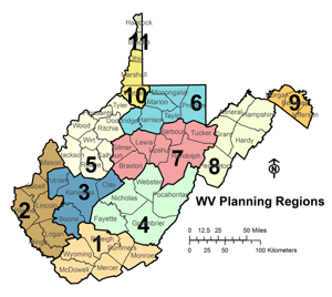
In 2009, the West Virginia Geological and Economic Survey (WVGES) received a grant from the Telecommunications and Information Administration (NTIA) State Broadband Data and Development Program (SBDD) to create a statewide map showing broadband coverage by type and transmission speed. The state map was updated semiannually for five years, with that data being submitted to the national broadband map for semiannual updates. Funds were available in this program to enable the eleven planning and development regions in the state to prepare strategic plans for broadband development in their areas, and those plans were assimilated into a state strategic broadband plan. Also included in the project were funds to create a technical assistance grant program focusing on broadband-related training, education, and online application development to enhance broadband usage in the state.
Broadband refers to high speed internet access and data transmission and is considered to be important for the economic development of the state and the nation. Many businesses and government agencies deliver audio, video and data services across high speed broadband connections. Broadband use has expanded to be essential in hospitals, clinics, emergency and public safety installations, and for online education as well as many other applications.


 1 Mont Chateau Road


