
County at a Glance - Barbour 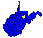
 History1,2: Formed in 1843 from parts of Randolph, Harrison,
and Lewis counties; named in honor of Philip Pendleton Barbour, Governor of
Virginia in 1811 as well as a distinguished jurist of that state.
History1,2: Formed in 1843 from parts of Randolph, Harrison,
and Lewis counties; named in honor of Philip Pendleton Barbour, Governor of
Virginia in 1811 as well as a distinguished jurist of that state.
Area (square miles)1: 345.41
County Seat1: Philippi
Population (2000)1: 15,557
Leading Industries and Chief Agricultural Products1: coal,
lumber, buckwheat, dairying, livestock, fruit, poultry, grain
Public Recreation Areas3: Audra State Park, Pleasant Creek
Wildlife Management Area, Teter Creek Wildlife Management Area, Tygart Lake
State Park
Coal Facts and Figures4

   Coal Reserve Summary
      Original Mineable Reserves = 3,585,619,298 tons
      Reported Production, 1883-1995 = 215,615,169 tons
      Estimated Loss = 215,615,169 tons
      Estimated Recoverable Reserves = 1,577,194,480 tons

   Coal Production, 1995
      Total Production = 2,063,619 tons
         Production from Underground Mines = 2,021,998 tons
         (Number of Underground Mines = 13)
            Conventional =   130,126 tons
              Continuous = 1,517,474 tons
                Longwall =   374,398 tons
                   Other =         0 tons
         Production from Surface Mines =        41,621 tons
         (Number of Surface Mines = 9)


Gas and Oil Facts and Figures5

   NOTE THAT THE FOLLOWING DATA ARE PRELIMINARY VALUES--
   NOT ALL 1995 DATA HAVE BEEN REPORTED AND
   NOT ALL 1995 DATA HAVE BEEN QUALITY CHECKED.

   Gas Production, 1995
      Total Reported Production = 7,363,909 thousand cubic feet (Mcf)
      Well Count = 1,446
      Average Production = 5,092.6 Mcf

   Oil Production, 1995
      Total Reported Production = 8,002 barrels (bbl)
      Well Count = 107
      Average Production = 74.8 bbl
1 Information Source = Counties in West Virginia Blue Book - 2001:
Darrell E. Holmes (ed.), Chapman Printing, vol. 83, p. 777-891.
2 Information Source = New Descriptive Atlas of West Virginia: 1933,
Clarksburg Publishing Company, 64 p.
3 Information Source = Departmental, Statistical, and General
Information in West Virginia Blue Book - 1995:
D. E. Holmes (ed.), Chapman Printing, vol. 77, p. 953-1038.
4 Information Source = Statistical Section in Annual Report
and Directory of Mines - 1995, West Virginia Office of
Miners' Health, Safety, and Training, July 1996, p. 23-66. [Note: Original
Mineable Reserves from the West Virginia Geological and Economic Survey (WVGES)]
5 Information Source = West Virginia Department of Environmental Protection (WVDEP); data have undergone a cursory quality check by the WVGES


 Page last revised: November 16, 2005
