
County at a Glance - Greenbrier 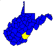
 History1,2: Second largest county in West Virginia. Created
in 1778 from parts of Montgomery and Botetourt counties (Virginia) and named
for the principal river which drains the county. The first permanent settlement
was established in 1769 at Frankford (unincorporated).
History1,2: Second largest county in West Virginia. Created
in 1778 from parts of Montgomery and Botetourt counties (Virginia) and named
for the principal river which drains the county. The first permanent settlement
was established in 1769 at Frankford (unincorporated).
Area (square miles)1: 1,022.80
County Seat1: Lewisburg
Population (1990)1: 34,693
Leading Industries and Chief Agricultural Products1: coal,
lumber, road materials, livestock, hay and grain, poultry, fruit, dairying
Public Recreation Areas3: Beartown State Park, Blue Bend
Recreation Area, Calvin W. Price State Forest, Greenbrier River Trail,
Greenbrier State Forest, North Bend Recreation Area, Sherwood Lake Recreation
Area, State Fairgrounds, Summit Lake Recreation Area
Coal Facts and Figures4

   Coal Reserve Summary
      Original Mineable Reserves = 1,220,293,321 tons
      Reported Production, 1883-1995 = 91,314,582 tons
      Estimated Loss = 60,876,388 tons
      Estimated Recoverable Reserves =640,861,411 tons

   Coal Production, 1995
      Total Production = 415,582 tons
         Production from Underground Mines = 324,213 tons
         (Number of Underground Mines = 17)
            Conventional =   8,650 tons
              Continuous = 314,704 tons
                Longwall =       0 tons
                   Other =     859 tons
         Production from Surface Mines =      91,369 tons
         (Number of Surface Mines = 23)


Gas and Oil Facts and Figures5

   Gas Production, 1995
      Total Reported Production = 0 thousand cubic feet (Mcf)
      Well Count = 0
      Average Production = 0 Mcf

   Oil Production, 1995
      Total Reported Production = 0 barrels (bbl)
      Well Count = 0
      Average Production = 0 bbl
1 Information Source = Counties in West Virginia Blue Book - 1995:
D. E. Holmes (ed.), Chapman Printing, vol. 77, p. 731-846.
2 Information Source = New Descriptive Atlas of West Virginia: 1933,
Clarksburg Publishing Company, 64 p.
3 Information Source = Departmental, Statistical, and General
Information in West Virginia Blue Book - 1995:
D. E. Holmes (ed.), Chapman Printing, vol. 77, p. 953-1038.
4 Information Source = Statistical Section in Annual Report
and Directory of Mines - 1995, West Virginia Office of
Miners' Health, Safety, and Training, July 1996, p. 23-66. [Note: Original
Mineable Reserves from the West Virginia Geological and Economic Survey (WVGES)]
5 Information Source = West Virginia Department of Environmental Protection (WVDEP); data have undergone a cursory quality check by the WVGES


 Page last revised: November 17, 2005
