
County at a Glance - Kanawha 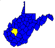
 History1,2: Formed from parts of Greenbrier and Montgomery
counties (Virginia) in 1788. Named for the Great Kanawha River, which
received its name from the Indian tribe which once dwelt in the territory
now embraced within the county.
History1,2: Formed from parts of Greenbrier and Montgomery
counties (Virginia) in 1788. Named for the Great Kanawha River, which
received its name from the Indian tribe which once dwelt in the territory
now embraced within the county.
Area (square miles)1: 913.38
County Seat1: Charleston
Population (1990)1: 207,619
Leading Industries and Chief Agricultural Products1: chemicals
and brines, coal, glass and glassware, petroleum, natural gas, axes and tools,
electric power, enamelware, lumber, mine machinery and equipment, dairying,
poultry, hay and grain, fruit, vegetables, livestock
Public Recreation Areas3: Kanawha State Forest
Coal Facts and Figures4

   Coal Reserve Summary
      Original Mineable Reserves = 5,901,324,612 tons
      Reported Production, 1883-1995 = 717,867,659 tons
      Estimated Loss = 478,578,439 tons
      Estimated Recoverable Reserves = 2,822,927,108 tons

   Coal Production, 1995
      Total Production = 10,452,761 tons
         Production from Underground Mines = 3,047,066 tons
         (Number of Underground Mines = 9)
            Conventional =         0 tons
              Continuous = 3,047,066 tons
                Longwall =         0 tons
                   Other =         0 tons
         Production from Surface Mines =     7,405,695 tons
         (Number of Surface Mines = 9)


Gas and Oil Facts and Figures5

   NOTE THAT THE FOLLOWING DATA ARE PRELIMINARY VALUES--
   NOT ALL 1995 DATA HAVE BEEN REPORTED AND
   NOT ALL 1995 DATA HAVE BEEN QUALITY CHECKED.

   Gas Production, 1995
      Total Reported Production = 14,577,681 thousand cubic feet (Mcf)
      Well Count = 2,353
      Average Production = 6,195.4 Mcf

   Oil Production, 1995
      Total Reported Production = 149,795 barrels (bbl)
      Well Count = 412
      Average Production = 363.6 bbl
1 Information Source = Counties in West Virginia Blue Book - 1995:
D. E. Holmes (ed.), Chapman Printing, vol. 77, p. 731-846.
2 Information Source = New Descriptive Atlas of West Virginia: 1933,
Clarksburg Publishing Company, 64 p.
3 Information Source = Departmental, Statistical, and General
Information in West Virginia Blue Book - 1995:
D. E. Holmes (ed.), Chapman Printing, vol. 77, p. 953-1038.
4 Information Source = Statistical Section in Annual Report
and Directory of Mines - 1995, West Virginia Office of
Miners' Health, Safety, and Training, July 1996, p. 23-66. [Note: Original
Mineable Reserves from the West Virginia Geological and Economic Survey (WVGES)]
5 Information Source = West Virginia Department of Environmental Protection (WVDEP); data have undergone a cursory quality check by the WVGES


 Page last revised: November 17, 2005
