
County at a Glance - Lewis 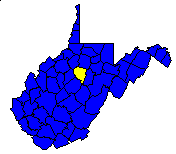
 History1,2: Created in 1816 from Harrison County. Named
for Colonel Charles Lewis, famous soldier and leader among the Virginia
pioneers, who was killed at the Battle of Point Pleasant in 1774.
History1,2: Created in 1816 from Harrison County. Named
for Colonel Charles Lewis, famous soldier and leader among the Virginia
pioneers, who was killed at the Battle of Point Pleasant in 1774.
Area (square miles)1: 391.35
County Seat1: Weston
Population (1990)1: 17,223
Leading Industries and Chief Agricultural Products1: glass
and glassware, petroleum, natural gas, lumber, livestock, dairying, hay,
grain, poultry
Public Recreation Areas3: Horner Game Refuge, Jackson's Mill
State 4-H Camp, Stonecoal Lake, Stonecoal Lake Wildlife Management Area,
Stonewall Jackson Lake, Stonewall Jackson Lake State Park
Coal Facts and Figures4

   Coal Reserve Summary
      Original Mineable Reserves = 2,776,037,160 tons
      Reported Production, 1883-1995 = 23,252,347 tons
      Estimated Loss = 23,252,347 tons
      Estimated Recoverable Reserves = 1,364,766,233 tons

   Coal Production, 1995
      Total Production = 31,988 tons
         Production from Underground Mines =  0 tons
         (Number of Underground Mines = 0)
            Conventional = 0 tons
              Continuous = 0 tons
                Longwall = 0 tons
                   Other = 0 tons
         Production from Surface Mines = 31,988 tons
         (Number of Surface Mines = 2)


Gas and Oil Facts and Figures5

   NOTE THAT THE FOLLOWING DATA ARE PRELIMINARY VALUES--
   NOT ALL 1995 DATA HAVE BEEN REPORTED AND
   NOT ALL 1995 DATA HAVE BEEN QUALITY CHECKED.

   Gas Production, 1995
      Total Reported Production = 9,881,337 thousand cubic feet (Mcf)
      Well Count = 1,970
      Average Production = 5,015.9 Mcf

   Oil Production, 1995
      Total Reported Production = 24,110 barrels (bbl)
      Well Count = 234
      Average Production = 103.0 bbl
1 Information Source = Counties in West Virginia Blue Book - 1995:
D. E. Holmes (ed.), Chapman Printing, vol. 77, p. 731-846.
2 Information Source = New Descriptive Atlas of West Virginia: 1933,
Clarksburg Publishing Company, 64 p.
3 Information Source = Departmental, Statistical, and General
Information in West Virginia Blue Book - 1995:
D. E. Holmes (ed.), Chapman Printing, vol. 77, p. 953-1038.
4 Information Source = Statistical Section in Annual Report
and Directory of Mines - 1995, West Virginia Office of
Miners' Health, Safety, and Training, July 1996, p. 23-66. [Note: Original
Mineable Reserves from the West Virginia Geological and Economic Survey (WVGES)]
5 Information Source = West Virginia Department of Environmental Protection (WVDEP); data have undergone a cursory quality check by the WVGES


 Page last revised: November 17, 2005
