
County at a Glance - Marshall 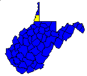
 History1,2: Formed from Ohio County in 1835 and named for
John Marshall, Chief Justice of the United States Supreme Court for
thirty-four years. Elizabethtown, named as the county seat in the act
creating the county, was combined with Moundsville in 1866.
History1,2: Formed from Ohio County in 1835 and named for
John Marshall, Chief Justice of the United States Supreme Court for
thirty-four years. Elizabethtown, named as the county seat in the act
creating the county, was combined with Moundsville in 1866.
Area (square miles)1: 315.26
County Seat1: Moundsville
Population (1990)1: 37,356
Leading Industries and Chief Agricultural Products1: iron
and steel, glass and glassware, chemicals, coal, clothing, natural gas, hay
and grain, dairying, fruit, vegetables, sheep
Public Recreation Areas3: Burches Run Wildlife Management
Area, Grave Creek Mound State Park
Coal Facts and Figures4

   Coal Reserve Summary
      Original Mineable Reserves = 4,448,857,374 tons
      Reported Production, 1883-1995 = 237,278,639 tons
      Estimated Loss = 237,278,639 tons
      Estimated Recoverable Reserves = 1,987,150,048 tons

   Coal Production, 1995
      Total Production = 7,934,648 tons
         Production from Underground Mines = 7,934,648 tons
         (Number of Underground Mines = 2)
            Conventional =         0 tons
              Continuous =   920,632 tons
                Longwall = 7,014,016 tons
                   Other =         0 tons
         Production from Surface Mines =             0 tons
         (Number of Surface Mines =0)


Gas and Oil Facts and Figures5

   NOTE THAT THE FOLLOWING DATA ARE PRELIMINARY VALUES--
   NOT ALL 1995 DATA HAVE BEEN REPORTED AND
   NOT ALL 1995 DATA HAVE BEEN QUALITY CHECKED.

   Gas Production, 1995
      Total Reported Production = 229,368 thousand cubic feet (Mcf)
      Well Count = 80
      Average Production = 2,867.1 Mcf

   Oil Production, 1995
      Total Reported Production = 4,580 barrels (bbl)
      Well Count = 14
      Average Production = 327.1 bbl
1 Information Source = Counties in West Virginia Blue Book - 1995:
D. E. Holmes (ed.), Chapman Printing, vol. 77, p. 731-846.
2 Information Source = New Descriptive Atlas of West Virginia: 1933,
Clarksburg Publishing Company, 64 p.
3 Information Source = Departmental, Statistical, and General
Information in West Virginia Blue Book - 1995:
D. E. Holmes (ed.), Chapman Printing, vol. 77, p. 953-1038.
4 Information Source = Statistical Section in Annual Report
and Directory of Mines - 1995, West Virginia Office of
Miners' Health, Safety, and Training, July 1996, p. 23-66. [Note: Original
Mineable Reserves from the West Virginia Geological and Economic Survey (WVGES)]
5 Information Source = West Virginia Department of Environmental Protection (WVDEP); data have undergone a cursory quality check by the WVGES


 Page last revised: November 17, 2005
