
County at a Glance - Nicholas 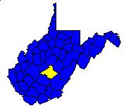
 History1,2: Formed in 1818 from parts of Kanawha, Greenbrier,
and Randolph counties and named from Wilson Cary Nicholas, Governor of Virginia
from 1814 to 1816.
History1,2: Formed in 1818 from parts of Kanawha, Greenbrier,
and Randolph counties and named from Wilson Cary Nicholas, Governor of Virginia
from 1814 to 1816.
Area (square miles)1: 656.77
County Seat1: Summersville
Population (1990)1: 26,775
Leading Industries and Chief Agricultural Products1: lumber,
coal mining, SMR Engineered Rubber Products, Columbia WV Plywood, potatoes,
livestock, river rafting
Public Recreation Areas3: Big Rock Recreation Area, Carnifex
Ferry Battlefield State Park, Summersville Lake, Summersville Lake Wildlife
Management Area, Woodbine Recreation Area
Coal Facts and Figures4

   Coal Reserve Summary
      Original Mineable Reserves = 6,172,807,449 tons
      Reported Production, 1883-1995 = 292,953,813 tons
      Estimated Loss = 195,302,542 tons
      Estimated Recoverable Reserves = 3,410,730,656 tons

   Coal Production, 1995
      Total Production = 4,557,692 tons
         Production from Underground Mines = 1,783,588 tons
         (Number of Underground Mines = 22)
            Conventional =    66,469 tons
              Continuous = 1,717,119 tons
                Longwall =         0 tons
                   Other =         0 tons
         Production from Surface Mines =     2,774,104 tons
         (Number of Surface Mines = 24)


Gas and Oil Facts and Figures5

   NOTE THAT THE FOLLOWING DATA ARE PRELIMINARY VALUES--
   NOT ALL 1995 DATA HAVE BEEN REPORTED AND
   NOT ALL 1995 DATA HAVE BEEN QUALITY CHECKED.

   Gas Production, 1995
      Total Reported Production = 2,226,572 thousand cubic feet (Mcf)
      Well Count = 345
      Average Production = 6,453.8 Mcf

   Oil Production, 1995
      Total Reported Production = 426 barrels (bbl)
      Well Count = 14
      Average Production = 30.4 bbl
1 Information Source = Counties in West Virginia Blue Book - 1995:
D. E. Holmes (ed.), Chapman Printing, vol. 77, p. 731-846.
2 Information Source = New Descriptive Atlas of West Virginia: 1933,
Clarksburg Publishing Company, 64 p.
3 Information Source = Departmental, Statistical, and General
Information in West Virginia Blue Book - 1995:
D. E. Holmes (ed.), Chapman Printing, vol. 77, p. 953-1038.
4 Information Source = Statistical Section in Annual Report
and Directory of Mines - 1995, West Virginia Office of
Miners' Health, Safety, and Training, July 1996, p. 23-66. [Note: Original
Mineable Reserves from the West Virginia Geological and Economic Survey (WVGES)]
5 Information Source = West Virginia Department of Environmental Protection (WVDEP); data have undergone a cursory quality check by the WVGES


 Page last revised: November 23, 2005
