
County at a Glance - Randolph 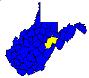
 History1,2: Formed in 1787 from Harrison County, Randolph
County originally included all of the present county of Tucker as well as
portions of Barbour, Upshur, Pocahontas, and Webster counties. Randolph
County lost territory between 1821 and 1860 as other, present counties were
formed; however, Randolph still remains the largest county in the state.
Randolph County was named in honor of Edmund Jennings Randolph, Governor of
Virginia from 1786 to 1788.
History1,2: Formed in 1787 from Harrison County, Randolph
County originally included all of the present county of Tucker as well as
portions of Barbour, Upshur, Pocahontas, and Webster counties. Randolph
County lost territory between 1821 and 1860 as other, present counties were
formed; however, Randolph still remains the largest county in the state.
Randolph County was named in honor of Edmund Jennings Randolph, Governor of
Virginia from 1786 to 1788.
Area (square miles)1: 1,046.34
County Seat1: Elkins
Population (1990)1: 27,803
Leading Industries and Chief Agricultural Products1: lumber,
furniture, coal, clothing, shoes, potatoes, hay and grain, livestock,
dairying
Public Recreation Areas3: Alpena Gap Recreation Area,
Bear Heaven Recreation Area, Bickle Knob Recreation Area, Dolly Sods Recreation
Area, Gaudineer Knob Recreation Area, Kumbrabow State Forest, Spruce Knob
Recreation Area, Stuart Recreation Area, Valley Bend Wetland
Coal Facts and Figures4

   Coal Reserve Summary
      Original Mineable Reserves = 4,183,643,819 tons
      Reported Production, 1883-1995 = 92,578,079 tons
      Estimated Loss = 61,718,719 tons
      Estimated Recoverable Reserves = 2,417,608,212 tons

   Coal Production, 1995
      Total Production = 675,844 tons
         Production from Underground Mines = 675,844 tons
         (Number of Underground Mines = 7)
            Conventional = 249,373 tons
              Continuous = 426,471 tons
                Longwall =       0 tons
                   Other =       0 tons
         Production from Surface Mines =           0 tons
         (Number of Surface Mines = 3)


Gas and Oil Facts and Figures5

   NOTE THAT THE FOLLOWING DATA ARE PRELIMINARY VALUES--
   NOT ALL 1995 DATA HAVE BEEN REPORTED AND
   NOT ALL 1995 DATA HAVE BEEN QUALITY CHECKED.

   Gas Production, 1995
      Total Reported Production = 2,339,674 thousand cubic feet (Mcf)
      Well Count = 527
      Average Production = 4,439.6 Mcf

   Oil Production, 1995
      Total Reported Production = 1,015 barrels (bbl)
      Well Count = 23
      Average Production = 44.1 bbl
1 Information Source = Counties in West Virginia Blue Book - 1995:
D. E. Holmes (ed.), Chapman Printing, vol. 77, p. 731-846.
2 Information Source = New Descriptive Atlas of West Virginia: 1933,
Clarksburg Publishing Company, 64 p.
3 Information Source = Departmental, Statistical, and General
Information in West Virginia Blue Book - 1995:
D. E. Holmes (ed.), Chapman Printing, vol. 77, p. 953-1038.
4 Information Source = Statistical Section in Annual Report
and Directory of Mines - 1995, West Virginia Office of
Miners' Health, Safety, and Training, July 1996, p. 23-66. [Note: Original
Mineable Reserves from the West Virginia Geological and Economic Survey (WVGES)]
5 Information Source = West Virginia Department of Environmental Protection (WVDEP); data have undergone a cursory quality check by the WVGES


 Page last revised: December 5, 2005
