 [Morgantown, WV - 11/16/2009]
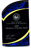
Staff of the Morgantown-based West Virginia Geological and Economic Survey (WVGES) won two State IT awards at the recent 2009 State Information Technology Conference in Charleston.
John Saucer, Susan Pool, and John Bocan won the award in the Collaboration Across Boundaries category for their work on the “Appalachian Basin Tight Gas Reservoirs Project”. This large-scale three-year project was funded by the US Department of Energy, in an effort to stimulate producers’ interest in developing unconventional regional sources of natural gas near eastern markets. The project received the state award for its web-based application and reservoir-based products that were developed in conjunction with the Pennsylvania Geological Survey. WVGES staff designed and developed the application; both state Surveys contributed data to the project. Several other WVGES full-time and project employees also collaborated on the project during the contract.
The Tight Gas Reservoirs Project application consists three major components: a conventional well data portion for more than 125,000 wells penetrating six selected tight gas reservoirs in the two states; a document viewer for access to scanned or digitized logs, core photos, and references for these reservoirs; and an interactive mapping component consisting of both a well data portal and an interactive spatial tool integrating maps and cross-sections. Data searches are enabled from any of the application’s three components. The project application is located at http://www.wvgs.wvnet.edu/atg/ .
In addition, John Saucer, John Bocan, and Susan Kite took home the award in the Digital Government: Government to Business category for their lead in collaborative work on the “pipeline-plus” project for delivering a variety of oil and gas well data to business, industry, and the public through an easy-to-use web-based interface. "pipeline-plus" is a popular application with a collection of tools and applications that allow users to search for, gather, access, and view many types of well-based data through a document viewer, with an option to export certain data to an Excel spreadsheet. Additionally, users can access the new West Virginia Oil and Gas (WVOG) interactive mapping interface to spatially display wells on a map – all in a single application over the internet. User-devised queries can help reduce and synthesize information on more 140,000 wells in West Virginia into smaller subsets of required information. This information is used not only by the oil and gas industry but also by the coal and other mineral industries, environmental firms, businesses and investors, and the general public. The application is located at
http://www.wvgs.wvnet.edu/pipe2/OGWISHelp.aspx .
Download the news release:
 Please send questions, comments, and/or suggestions to webmaster.
Page created and maintained by:
            West Virginia Geological and Economic Survey
  Address:  Mont Chateau Research Center
            1 Mont Chateau Road
            Morgantown, WV  26508-8079
Telephone:  304-594-2331
      FAX:  304-594-2575
    Hours:  8:00 a.m. - 5:00 p.m. EST, Monday - Friday
Permission to reproduce this material is granted if acknowledgment is given to the West Virginia Geological and Economic Survey.