
STATEMAP Projects for 2001:
Moorefield Quadrangle, Hardy County, West Virginia
WVGES Home Page >
STATEMAP Home Page >
Moorefield Quadrangle >
Surficial Geology

SURFICIAL GEOLOGY
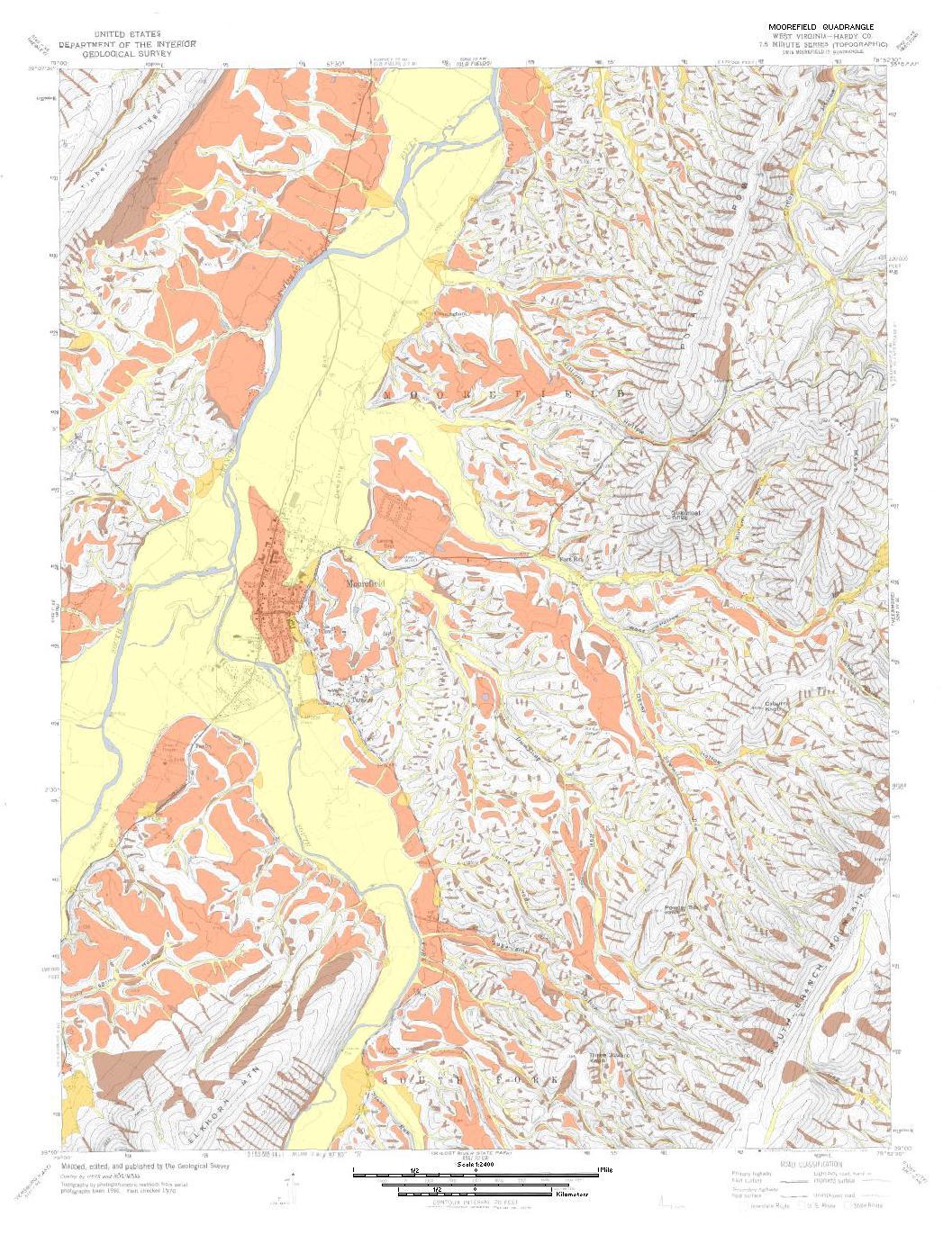
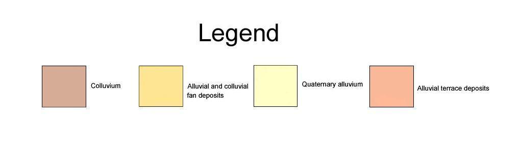 The surficial geology mapeld 7.5-minute quadrangle covers part
of the Valley and Ridge physiographic province in Hardy County, West Virginia.
This province covers most of the eastern panhandle of West Virginia where the
rock formations, topography, and major structural elements all trend northeast.
It is characterized by a series of long, narrow mountains, primarily composed
of resistant sandstone, with intervening valleys composed of less resistant
siltstone, shale, and limited carbonate rocks (Lessing and others, 1991). Surficial
deposits consist of extensive alluvium in river valleys, alluvial terrace deposits,
colluvium at the base of steep slopes and in headward reaches of tributary streams,
landslide deposits and widespread alluvial and colluvial fans.
Geological mapping was completed in 2000 and 2001. Both high- and low-altitude
aerial photographs (black and white, and color infrared) and side-looking aerial
radar (SLAR) were used in conjunction with field mapping. A description of unconsolidated
deposits is included. The surficial geology is the first published mapping of
these extensive materials into different unconsolidated deposits.
Purchase of more detailed Bedrock and Surficial Geologic Maps may be done through WVGES Publications (see
Open File Reports).
The surficial geology mapeld 7.5-minute quadrangle covers part
of the Valley and Ridge physiographic province in Hardy County, West Virginia.
This province covers most of the eastern panhandle of West Virginia where the
rock formations, topography, and major structural elements all trend northeast.
It is characterized by a series of long, narrow mountains, primarily composed
of resistant sandstone, with intervening valleys composed of less resistant
siltstone, shale, and limited carbonate rocks (Lessing and others, 1991). Surficial
deposits consist of extensive alluvium in river valleys, alluvial terrace deposits,
colluvium at the base of steep slopes and in headward reaches of tributary streams,
landslide deposits and widespread alluvial and colluvial fans.
Geological mapping was completed in 2000 and 2001. Both high- and low-altitude
aerial photographs (black and white, and color infrared) and side-looking aerial
radar (SLAR) were used in conjunction with field mapping. A description of unconsolidated
deposits is included. The surficial geology is the first published mapping of
these extensive materials into different unconsolidated deposits.
Purchase of more detailed Bedrock and Surficial Geologic Maps may be done through WVGES Publications (see
Open File Reports).


Page last revised: January 11, 2006
