 STATEMAP Project for 2005:
MOZER Quadrangle
STATEMAP Project for 2005:Preliminary Bedrock Geologic Map of the Mozer Quadrangle
Publication OF-0505
Principal Investigators: Ronald McDowell, Katharine Lee Avary, and James Britton (WVGES)
Contributing Investigators: Dave Matchen (Concord University)
Geological Assistants: Laura Walkup (West Virginia University); Paula Waggy (Pendleton County Middle School, Franklin, WV);
Mary Sue Burns (Pocahontas County High School, Dunmore, WV)
Reconnaissance bedrock mapping and geochemical sampling were carried out on the Mozer, West Virginia quadrangle (see location map above) from May 2005 through May 2006 by investigators Ronald McDowell, Katharine Lee Avary, and James Britton (WVGES) and cooperating investigator Dr. David L. Matchen (Concord University). An undergraduate student from West Virginia University, Laura Walkup, and two K-12 teachers, Paula Waggy (Franklin, WV) and Mary Sue Burns (Dunmore, WV), worked as geological field assistants for part of the field season. Funding for their salaries and field expenses was provided, in part, by the West Virginia Geological and Economic Survey.
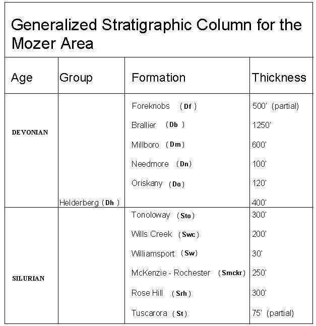
Rock units in the Mozer area range in age from Silurian through Devonian. Shown above is a chart of the stratigraphic units encountered in the mapping area.
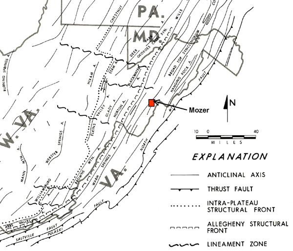
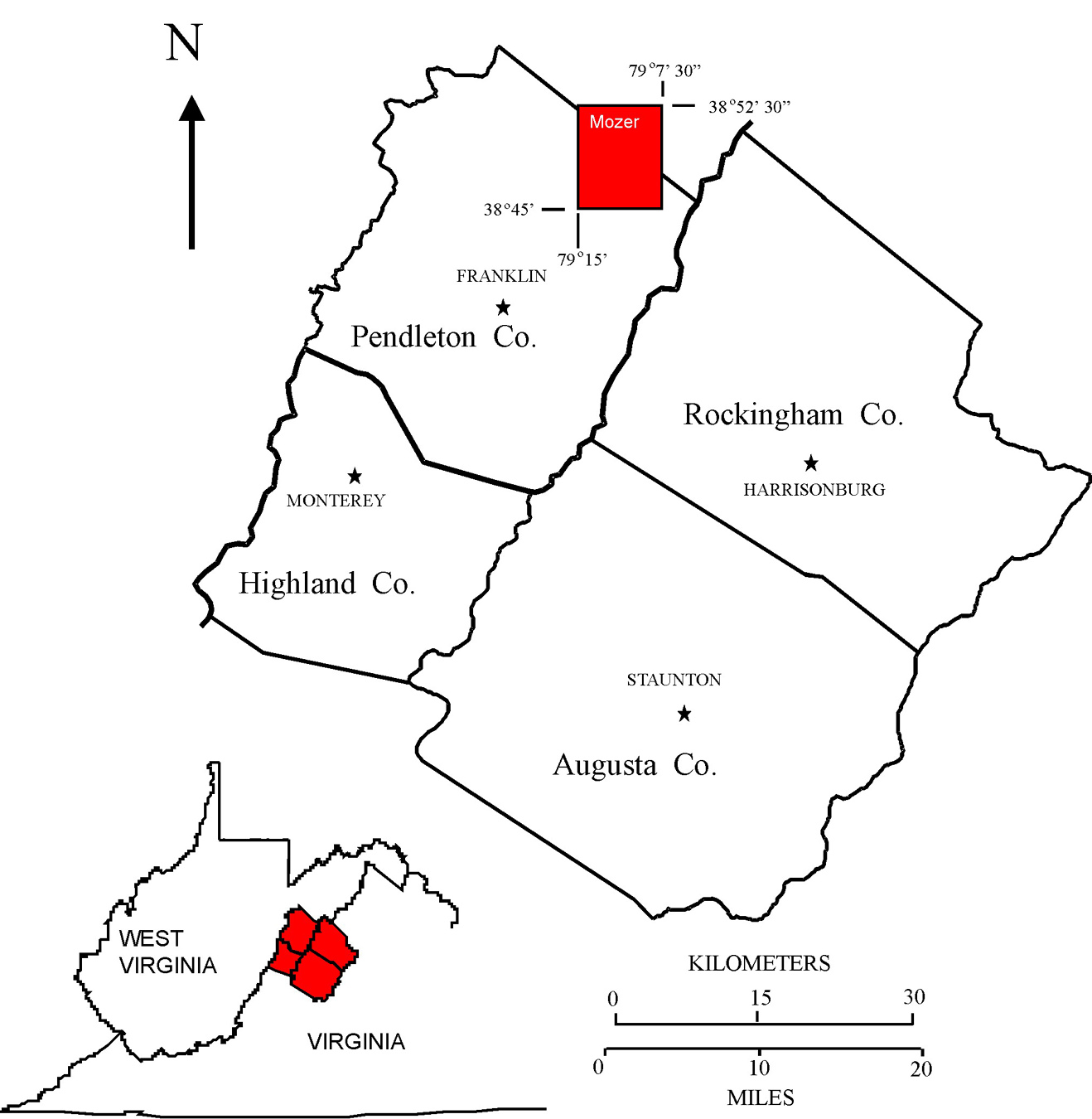
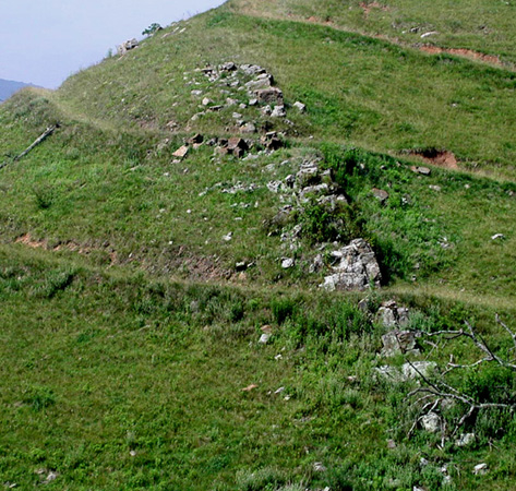
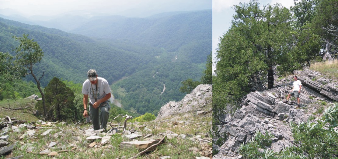
The Mozer quadrangle, located in the Valley and Ridge physiographic province (see figure above modified from Kulander and Dean, 1978), lies within a very complex deformational regime. This deformation takes the form of intense folding and thrust faulting. Strikes, fold axes, and fault traces generally trend northeast-southwest. Construction of cross-sections suggests that the thrust fault that bisects the map area is deeply rooted in the Ordovician shales present in the subsurface, in particular, the Reedsville Formation. Fault deformation propagates readily through the Silurian and Devonian shales. Resistant Devonian carbonates and sandstones are thrust against less resistant sedimentary units. This implies that west-vergent compression first folded the strata of the area; then, as folds continued to close, structures "broke" and strata were thrust westward. The Silurian-Devonian Helderberg Group carbonates and Devonian Oriskany Sandstone are the dominant ridge formers in the Mozer area. However, Middle Mountain, one of the prominent topographic "highs" in the western half of the quadrangle, is large syncline cored by shales, siltstones, and sandstones of the Devonian Brallier and Foreknobs formations. As on nearby quadrangles, the Silurian Williamsport Sandstone, although one of the thinner units within the area, plays a predominant role in helping to unravel the complex structure. Unfortunately, the Williamsport, along with most of the Silurian, only crops out in the south-central portion of the quadrangle. The photograph below illustrates the resistant nature of the Williamsport which is ~8 m thick here and dips steeply to the northwest.
Sometimes, when access to a particular portion of the map is difficult or impossible given the time constraints of the summer mapping season, it is necessary to examine similar strata on adjacent and more accessible map areas. Cave Mountain in the northwest corner of the Mozer Quadrangle proved to be one such area. No road access was possible from the Mozer Quadrangle, however, we were able to visit the northeast end of the Mountain via jeep trail from the Petersburg West Quadrangle. Since Cave Mountain is oriented strike-parallel (northeast-southwest), the formations exposed on the southwest end of the Mountain on the Mozer Quad are the same as those on the northeast end on Petersburg West. Consequently, structural measurements and rock descriptions taken on Petersburg West could be projected back onto the Mozer map.
On the left, geologist Jim Britton examines a stromatoporoid buildup at the base of the Siluro-Devonian Helderberg Group on Cave Mountain. Big Bend Campground in the Monongahela National Forest is visible in background approximately one mile to the west. On the right, Dave Alt (Hatchery Manager, Reed's Creek Fish Hatchery, Ruddle, WV) stands on steeply dipping strata of the Silurian Tonoloway Formation exposed beneath the Helderberg on Cave Mountain.
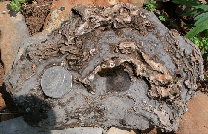
The lower Helderberg Group (Keyser Member) is characterized by buildups of reef- and mound-forming organisms. Depending on the location, these organisms might be algae, sponges, stromatoporoids, or corals. Shown above is an example of a stromatoporoid head observed on Cave Mountain. The normal calcite mineralogy of the stromatoporoid has been replaced by silica (SiO2) probably long after the Helderberg had solidified into rock. The coin is three centimeters in diameter.
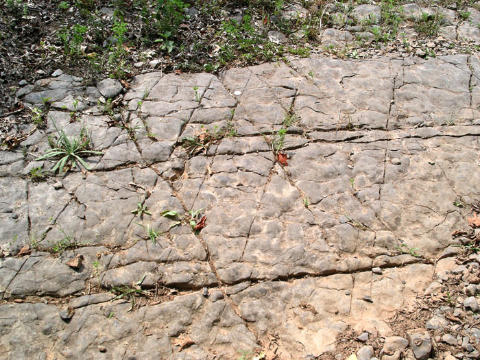
Shown above is an irregular bedding surface from the lower Helderberg at Cave Mountain typical of carbonates formed by algal mats. Because they are generated by living marine organisms, such surfaces are only roughly conformable to the sea floor. Different portions of the mat grow at different rates giving the mat an irregular, wrinkled topography consisting of small hills and valleys. Also visible on this surface are a series of regular shaped fractures or joints that formed long after the algal mats were turned into rock. The orientation of the joints indicates that the direction of maximum compression of the rocks in this photograph is from top (west) to bottom (east).
Heavy vegetation and soil cover hamper the delineation of formation contacts. When bedrock is poorly exposed and outcrops are small and separated by long distances, it may be difficult to decide to which formation the exposed rock belongs. The more resistant rock units like the Silurian Tuscarora, Rose Hill, and Williamsport, and the Devonian Oriskany and Helderberg formations, even though faulted and fractured, are usually still recognizable in isolated outcrop. This may not be the case for the shales and the Silurian Tonoloway and Wills Creek carbonates. Even worse, in the situation where no bedrock is exposed, the geologist must still try to determine the formation and type of bedrock underlying the land surface. To accomplish this task, geologists sometime rely on proxies to help them with this determination.
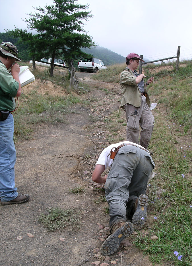
Shown above, three WVGES geologists look for nearly microscopic fossils that might help differentiate the Devonian Needmore Shale from the overlying Millboro.
A total of 31 bedrock samples were collected for geochemical analysis during the field season. These analytical results have been combined with results from past year's STATEMAP projects in a geochemical database available to the general public as West Virginia Geological Survey Report of Investigations RI-34 (McDowell, 2001). Concurrent with this year's STATEMAP project, the geochemical database has been fully revised. A new, GIS-based version of the database is in preparation.
![]()
![]()
Page last revised May 2005
Page created and maintained by:
            West Virginia Geological & Economic Survey
  Address:  Mont Chateau Research Center
            1 Mont Chateau Road
            Morgantown, WV  26508
Telephone:  1-800-WV-GEOLOgy (1-800-984-3656) or 304-594-2331
      FAX:  304-594-2575
    Hours:  8:00 a.m. - 5:00 p.m. EST, Monday - Friday
Permission to reproduce this material is granted if acknowledgment is given
to the West Virginia Geological and Economic Survey.