 STATEMAP Project for 2008:
Hightown Quadrangle
STATEMAP Project for 2008:Preliminary Bedrock Geologic Map of the West Virginia Portion of the Hightown Quadrangle
Publication OF-0804
Principal Investigators: Ronald McDowell, Eric Lewis, Katharine Lee Avary, James Britton (WVGES)
Geological Assistants: Mark Van Dyke (West Virginia University, Morgantown, WV); Jaana Hitzig (Concord University, Athens, WV)
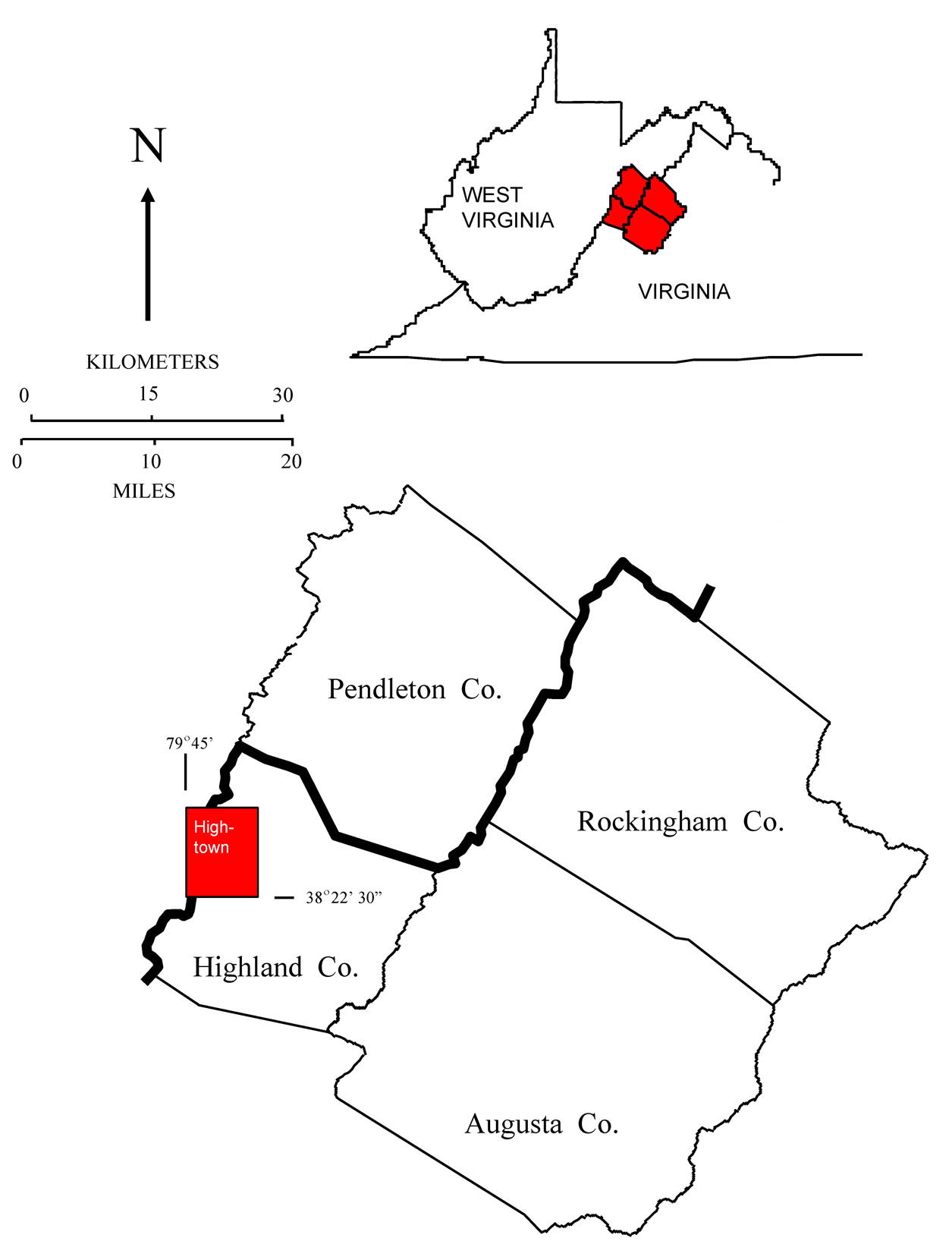
Reconnaissance bedrock mapping and geochemical sampling were carried out on the Hightown, West Virginia-Virginia quadrangle (see location map above) from May 2008 through July 2008 by investigators Ronald McDowell, Eric Lewis, Katharine Lee Avary, and James Britton (WVGES). Two undergraduate students, Jaana Hitzig (Concord University, Athens, WV) and Mark Van Dyke (West Virginia University, Morgantown, WV), worked as geological field assistants for the field season. Funding for their salaries and field expenses was provided by the West Virginia Geological and Economic Survey.
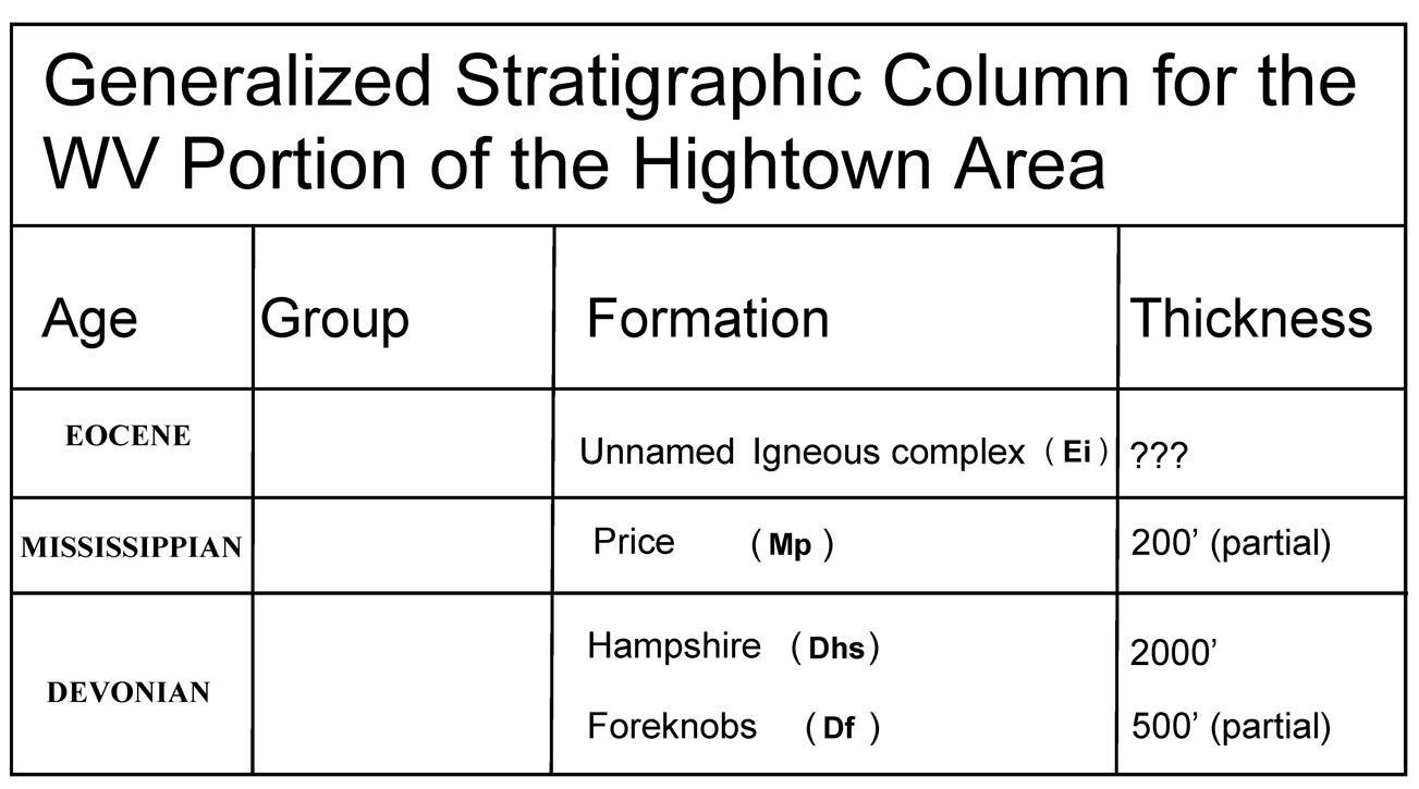
Rock units in the West Virginia portion of the Hightown area range in age from Devonian through Eocene. Shown above is a chart of the stratigraphic units encountered in the mapping area.
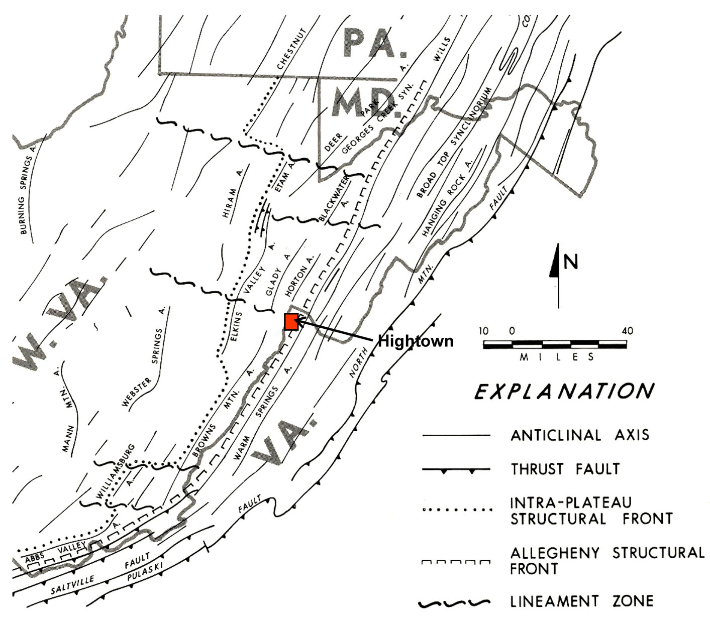
The Hightown quadrangle straddles the boundary between the Appalachian Plateau and the Valley and Ridge physiographic provinces(see figure above modified from Kulander and Dean, 1978). The West Virginia portion of the quadrangle lies on the Plateau side of this boundary and, as such, exhibits less deformation than seen just a few miles to the east in the Valley and Ridge. The deformation present takes the form of broad, gentle folding with axes trending generally northeast-southwest. Two named structural features, the Horton Anticline and the Stony River Syncline (not shown in the figure above), cross the northwest corner of the quadrangle. Because of generally shallow dips, the Stony River Syncline becomes barely recognizable to the southwest. A number of lesser, intervening anticlines and synclines also are present in the same area
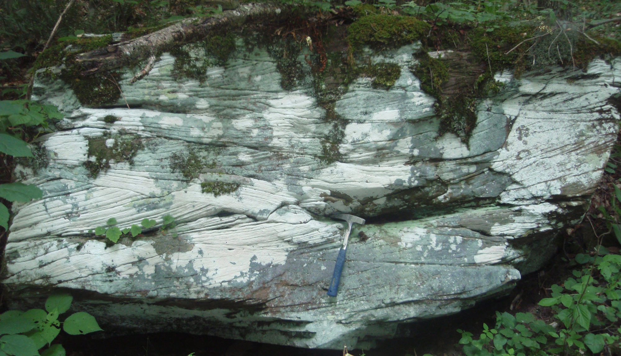
Heavy vegetation and soil cover hamper the delineation of contacts except where the most resistant units are present; in addition, extremely limited road and trail access forced the authors to rely heavily on aerial photography, SLAR imagery, and adjacent bedrock quadrangle maps, particularly McDowell and others, 2002 and an unpublished map based on photogeological interpretation (Martin, 1991) of structure and stratigraphic contacts in the quadrangle. In general, the Devonian Hampshire Formation weathers to dark reddish soil. Where bedrock is poorly exposed, these soils serve as a proxy for the Hampshire. Shown below is an outcrop of strongly cross-bedded Hampshire on the Hightown quad - rock hammer for scale
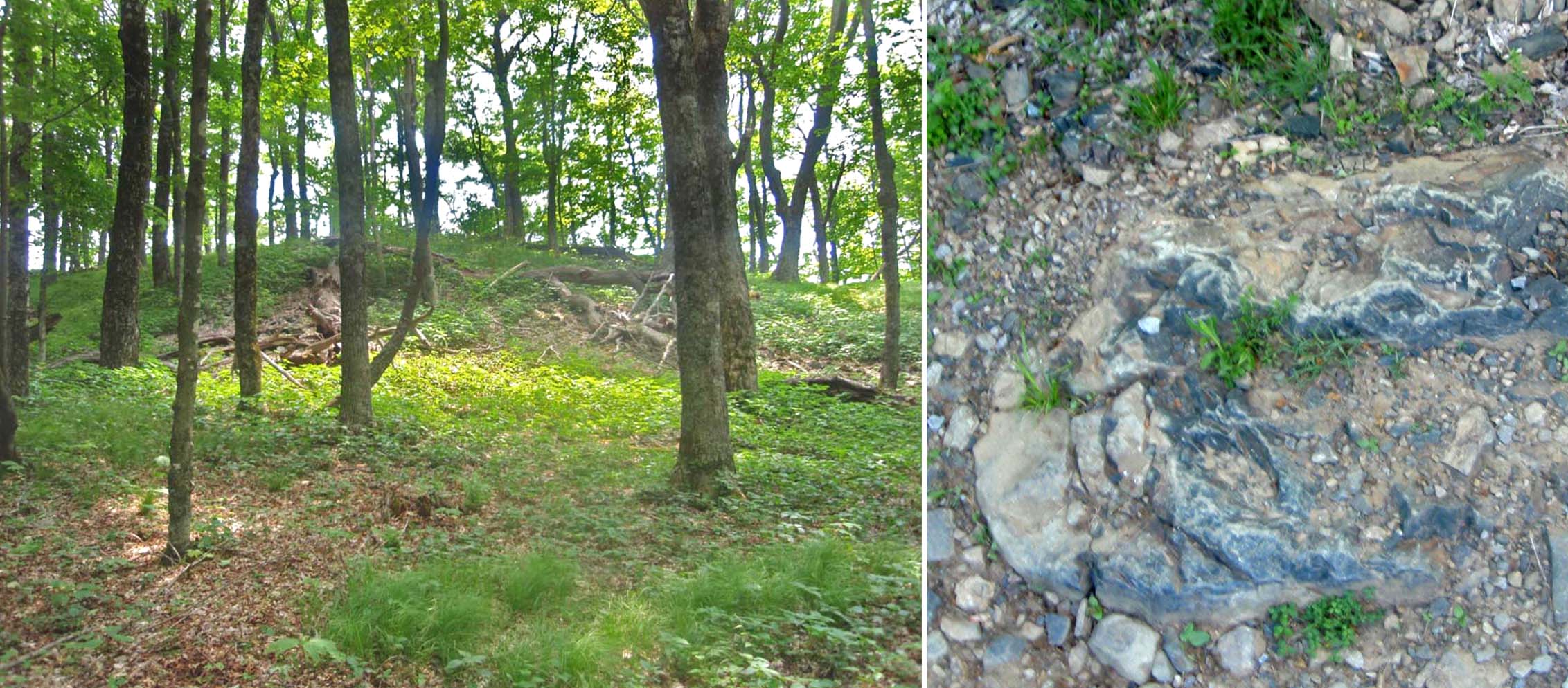
Despite reports to the contrary - "No trace of igneous or quartzite instrusions . . . are known to occur in this area. Neither are plugs or dikes known to occur . . ." (Price and Reger, 1929, p. 321) - three igneous intrusive bodies were encountered on the quadrangle. Shown below are examples of typical basalt outcrops on the Hightown quad - they are easy to overlook except for the distinctly different nature of the exposed rock. Although poorly exposed, enough material was present to determine that the rock making up these bodies resembles that recovered in adjacent Pendleton County, WV and Highland County, VA. These shallow intrusive igneous rocks are unusual in that they exhibit generally aphanitic textures of extrusive igneous rocks - again, similar to rocks encountered in adjacent areas to the north and east. Southworth and others (1993) dated the majority of these igneous rocks as Eocene in age. The igneous rocks of the Hightown quadrangle range from amygdaloid and porphyritic basalts to porphyritic olivine basalts. Rhyolitic and diatreme materials observed in both Pendleton and Highland counties were not present.
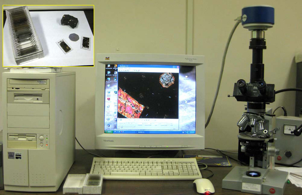
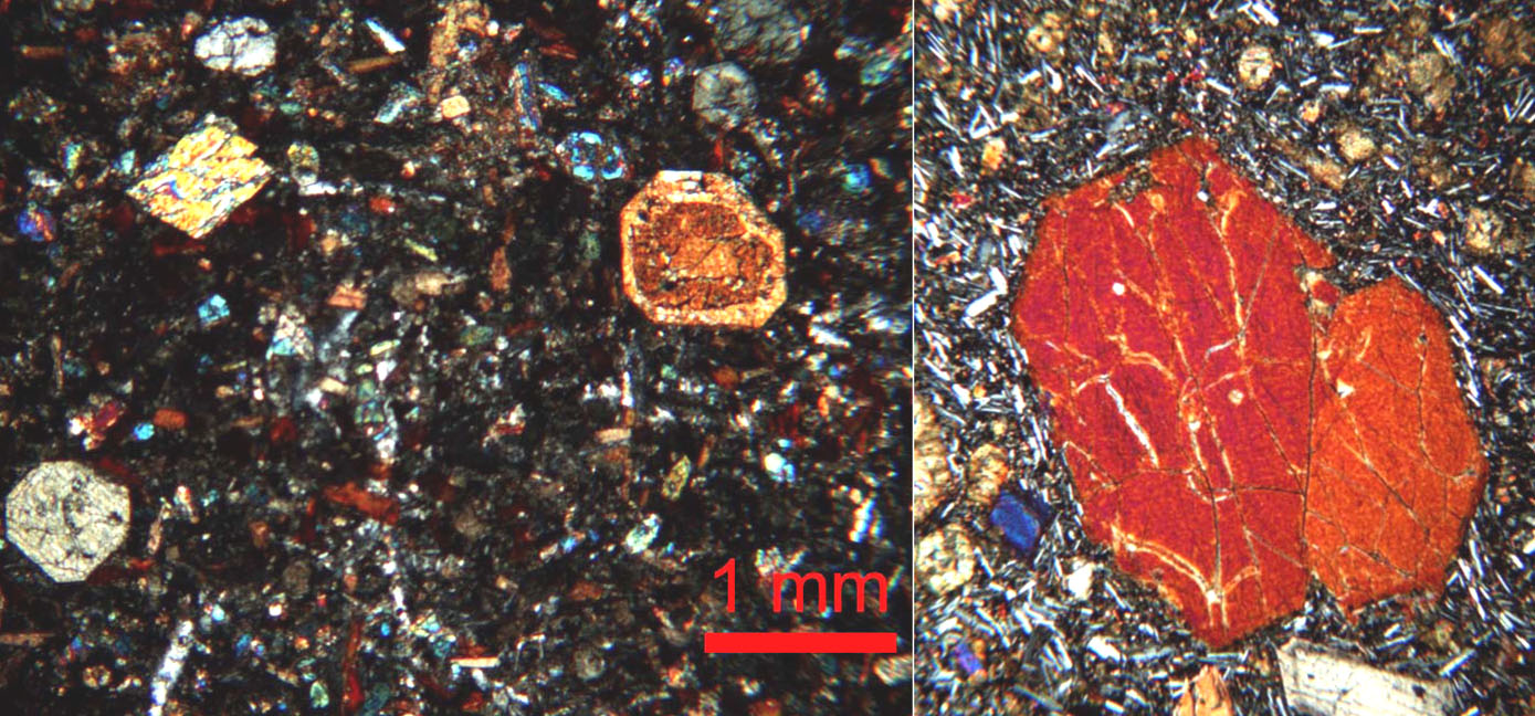
Once rock samples have been collected and brought back to WVGES for further study, many of them are subjected to closer examination. Small slices of rock are cut using a masonry trim saw with a diamond-impregnated blade and then sent off to commercial laboratory to be turned into thin sections. Rock slices approximately 20 x 40 mm in size are glued to glass slides with clear epoxy and then ground down to a uniform thickness of approximately 0.3 mm. Once returned to WVGES, individual thin sections are examined in both plain and polarized, transmitted and reflected light and interesting features are photographed electronically. Above, photomicrographic workstation at WVGES facility. On the right, a Leitz microscope with digital camera mounted on top. Digital images are sent for storage to the computer on the right. The inset in the upper left of the picture shows examples of prepared thin sections - for scale, the coin is 3 cm in diameter. Below, photomicrographs of typical Eocene basalt from eastern WV. The relatively large, brilliantly colored crystals in both parts of the image are examples of pyroxenes (probably augite - (Ca,Mg,Fe)SiO3). The smaller, lath-shaped gray and white crystals visible on the right are feldspars (probably calcium-rich plagioclase (Ca,Na)Al(Si,Al)Si2O6). Plagioclase feldspars make up the aphanitic (very fine-grained) portion of the basalt whereas the considerably larger crystals of pyroxene give the rock its porphyritic (mixed very coarse- and very fine-grained) texture which indicates a complex cooling history for the rock.
A total of 23 bedrock samples were collected for geochemical analysis during the field season. These analytical results have been combined with results from past year's STATEMAP projects in a geochemical database available to the general public as West Virginia Geological Survey Report of Investigations RI-34 (McDowell, 2001). Concurrent with this year's STATEMAP project, the geochemical database has been brought up to date and summary statistics fully revised. A GIS-compatible version of the database is currently available.
![]()
![]()
Page last revised May 2009
Page created and maintained by:
            West Virginia Geological & Economic Survey
  Address:  Mont Chateau Research Center
            1 Mont Chateau Road
            Morgantown, WV  26508
Telephone:  1-800-WV-GEOLOgy (1-800-984-3656) or 304-594-2331
      FAX:  304-594-2575
    Hours:  8:00 a.m. - 5:00 p.m. EST, Monday - Friday
Permission to reproduce this material is granted if acknowledgment is given
to the West Virginia Geological and Economic Survey.