 STATEMAP Project for 2009:
Paddy Knob and Mustoe Quadrangles
STATEMAP Project for 2009:Preliminary Bedrock Geologic Map of the West Virginia Portion of the Paddy Knob and Mustoe Quadrangles
Publication OF-0902
Principal Investigators: Ronald McDowell, Paula Hunt, Eric Lewis, Keri Wilson, Katharine Lee Avary (WVGES)
Geological Assistants: Mary Sue Burns (Pocahontas County High School, Dunmore, WV); Christine Smith (Pocahontas County Board of
Education, Dunmore, WV)
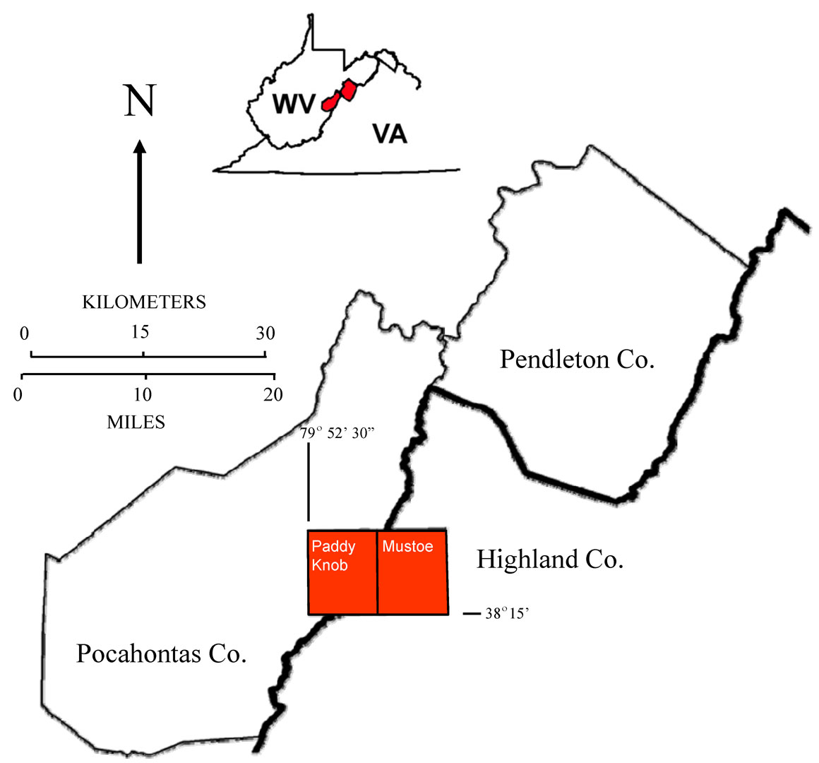
Reconnaissance bedrock mapping and geochemical sampling were carried out on the Paddy Knob and Mustoe, West Virginia-Virginia quadrangles (see location map above) from May 2009 through April 2010 by investigators Ronald McDowell, Paula Hunt, Eric Lewis, Keri Wilson, and Katharine Lee Avary (WVGES). Two secondary school teachers, Mary Sue Burns (Pocahontas High School, Dunmore, WV) and Christine Smith (Pocahontas County Board of Education, Dunmore, WV), worked as geological field assistants for the field season. Funding for their salaries and field expenses was provided by the West Virginia Geological and Economic Survey.
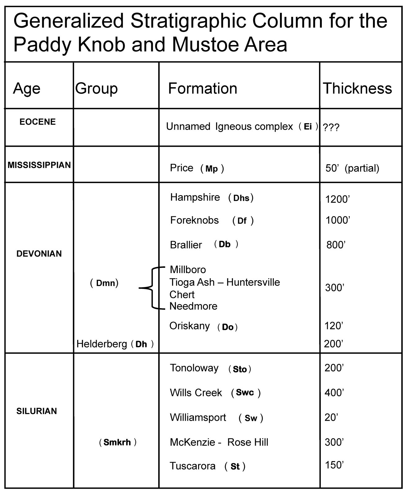
Rock units in the West Virginia portion of the Paddy Knob and Mustoe area range in age from Silurian through Eocene. Shown above is a chart of the stratigraphic units encountered in the mapping area.
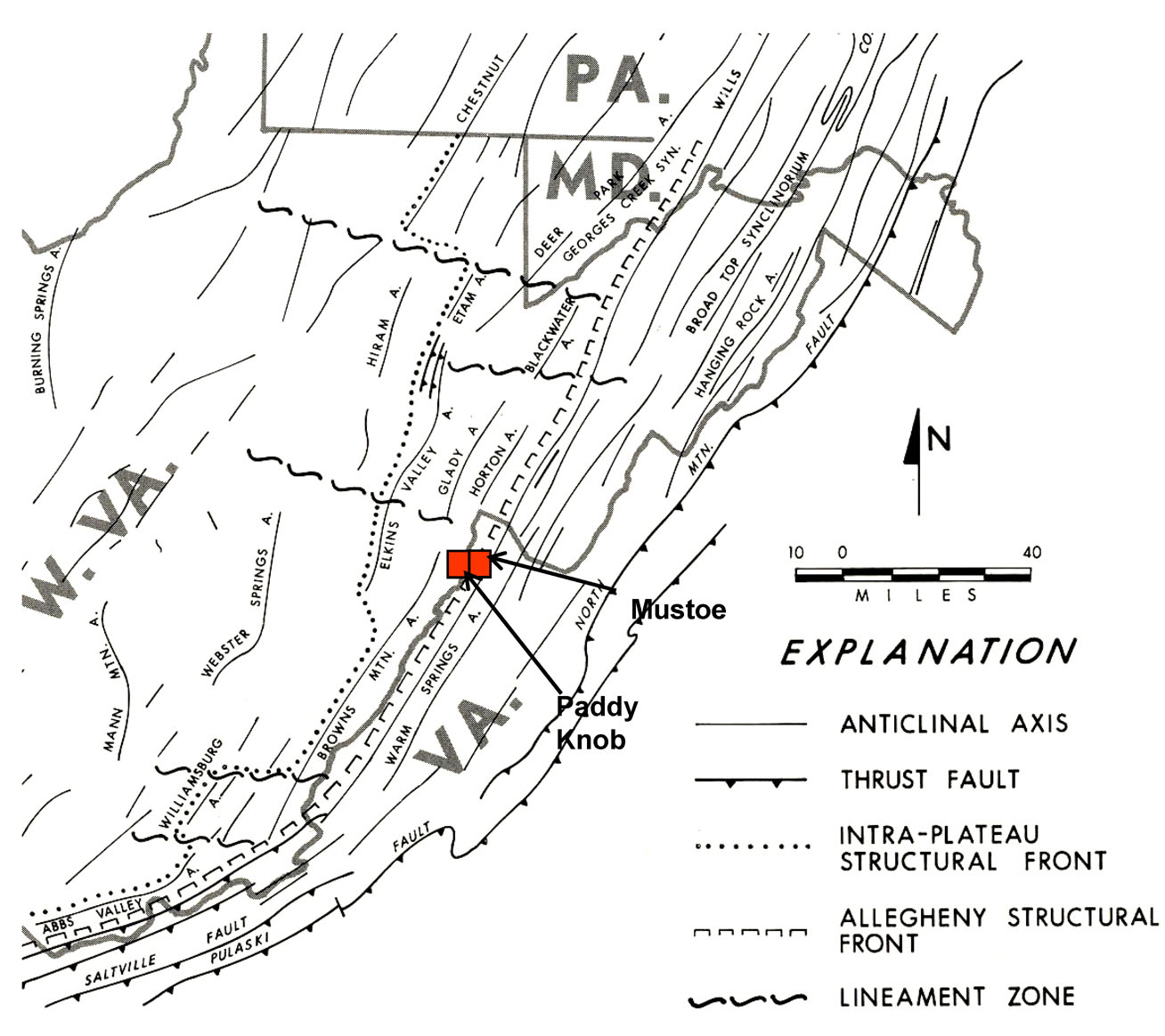
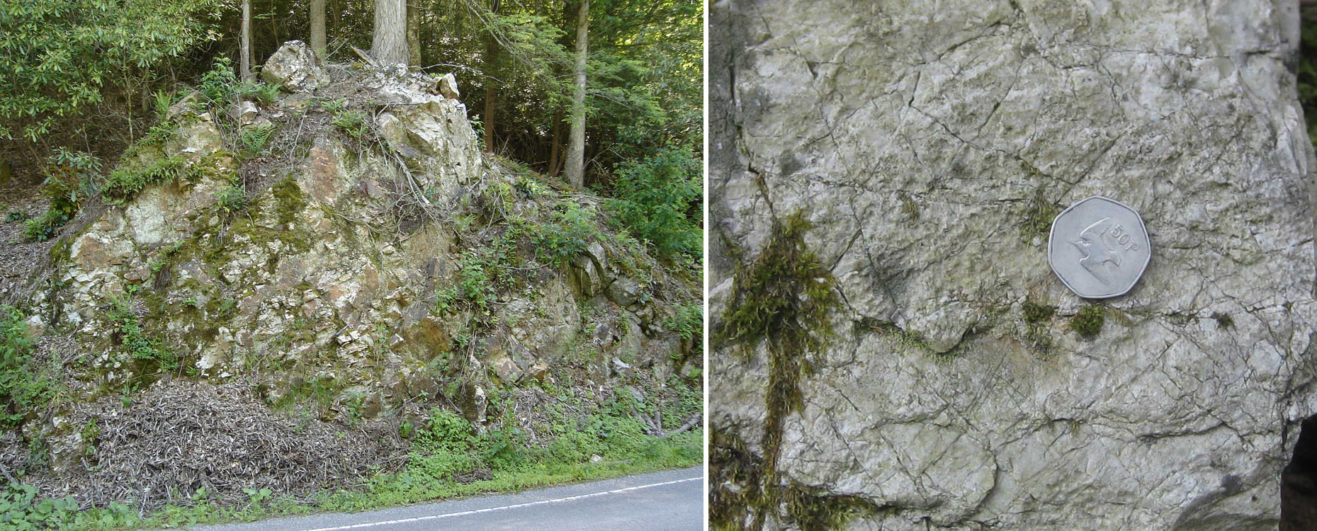
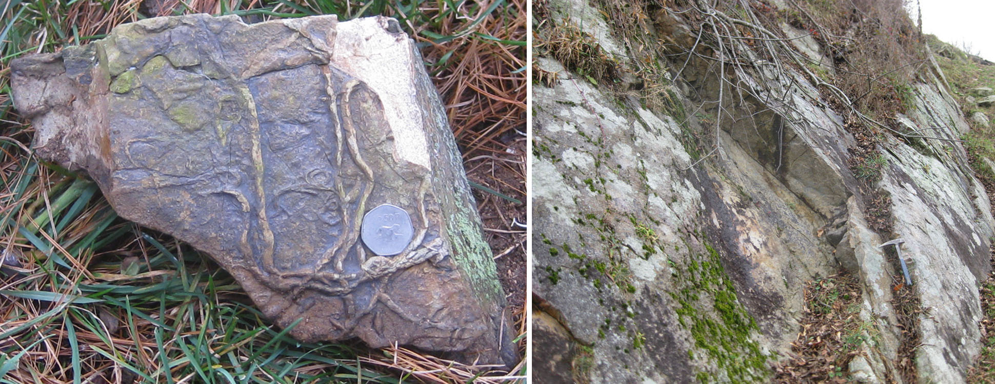
The Paddy Knob and Mustoe quadrangles straddles the boundary between the Appalachian Plateau and the Valley and Ridge physiographic provinces(see figure above modified from Kulander and Dean, 1978). As a result, the quadrangles exhibit a mixture of very complex and moderate deformation. This deformation takes the form of folding and faulting that increases in intensity to the northwest. Strikes, fold axes, and fault traces generally trend northeast-southwest. The cross-section created for the Paddy Knob-Mustoe project suggests that intense folding in the west-central portion of the map associated with the Brown's Mountain Anticline was probably initiated by thrust faulting deeply rooted in Silurian or Ordovician shales present in the subsurface. Deformation propagates readily through overlying units resulting in west-vergent compressional folding of strata in the area. The Silurian-Devonian Helderberg carbonates and Silurian Tuscarora Sandstone are the dominant ridge formers in the western half of the Paddy Knob Quadrangle. As observed on quadrangles farther to the north, where exposed, the Silurian Williamsport Sandstone forms an excellent marker bed when interpreting the complex structure in the map area. The photos below show views of deformed Silurian rocks in the Brown's Mtn. Anticline: below left, Tuscarora Sandstone along WV 92 south of Dunmore, WV; on the right, example of brittle deformation (fracturing) in the Tuscarora south of Dunmore, WV. Coin is 3 cm in diameter.
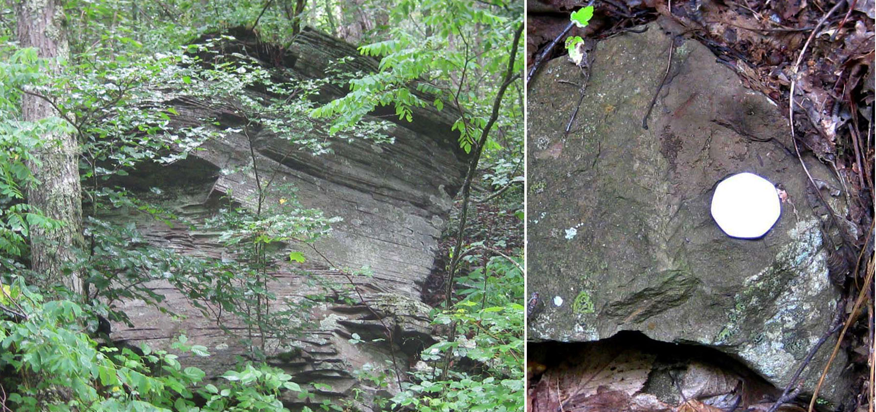
Above left, unidentified feeding trace fossils on the bottom of Silurian Williamsport Sandstone southeast of Dunmore, WV. Coin is 3 cm in diameter; on the right, southeast dipping Williamsport at the same locality.
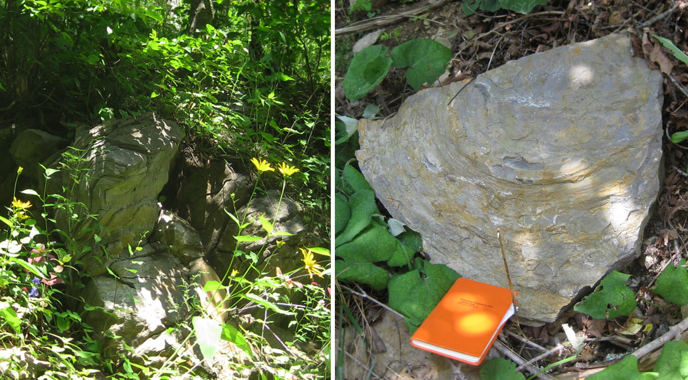
Heavy vegetation and soil cover hamper the delineation of contacts except where the most resistant units are present; in addition, extremely limited road and trail access forced the authors to rely heavily on aerial photography, SLAR imagery, and the Dissertation map of Kulander, 1968, for the interpretation of structure and stratigraphic contacts in both quadrangles. In addition, a number of the Silurian map units were so poorly exposed that their characterization had to be taken from the adjacent Clover Lick quadrangle to the west. In previous years, the Devonian Needmore and Millboro shales have been observed as distinct mapping units, generally separated by the thin Tioga Ash. For this project, the situation was complicated by the presence of multiple Tioga ashfall layers observed to be interbedded with both the Needmore and a glauconitic sandstone, the Bobs Ridge. Making matters worse, much of the Needmore and Tioga were heavily silicified (the Huntersville Chert) and as a result, the Needmore and Millboro could not be consistently differentiated. Likewise, the Silurian McKenzie and Rose Hill Formations, which are distinctive, mappable units farther to the north because of the presence of the intervening Keefer ironstone and prominent ferruginous sandstones in the Rose Hill, were greatly reduced in thickness. We believe this thinning is related to changing of sedimentary facies which resulted in the loss of resistant sandstones in the Rose Hill - the two units were not differentiated within the map area. In the eastern half of that map and along the western edge of the Mustoe Quadrangle, resistant sandstones of the Devonian Foreknobs or Hampshire formations form ridge crests. In general, the Devonian Hampshire Formation weathers to dark reddish soils. Where bedrock is poorly exposed, these soils served as a proxy for the Hampshire. However, caution was necessary because the Devonian Foreknobs Formation in the map area contains a dark red, fossiliferous member that might be confused with the Hampshire and also produced dark reddish soils. Below left, an outcrop of strongly cross-bedded Hampshire; on the right, an example of the plant fossil Archaeopteris sp. in the Hampshire with 3 cm coin for scale.
Silurian carbonate units, particularly the Tonoloway and Wills Creek limestones on the western Paddy Knob quad, show similar deformation to that seen in the Silurian sandstones with the exception that the carbonates are more likely to exhibit ductile deformation (folding). The Tonoloway in the map area was notable for well-preserved algal stromatolites. Below left, folding in the Tonoloway Limestone in a 1 m outcrop along Pocahontas Co. 13 west of Dunmore, WV; on the right, a piece of a domal algal stromatolite found along WV 92 south of Dunmore, WV. Viewed from the underside with a field notebook for scale.
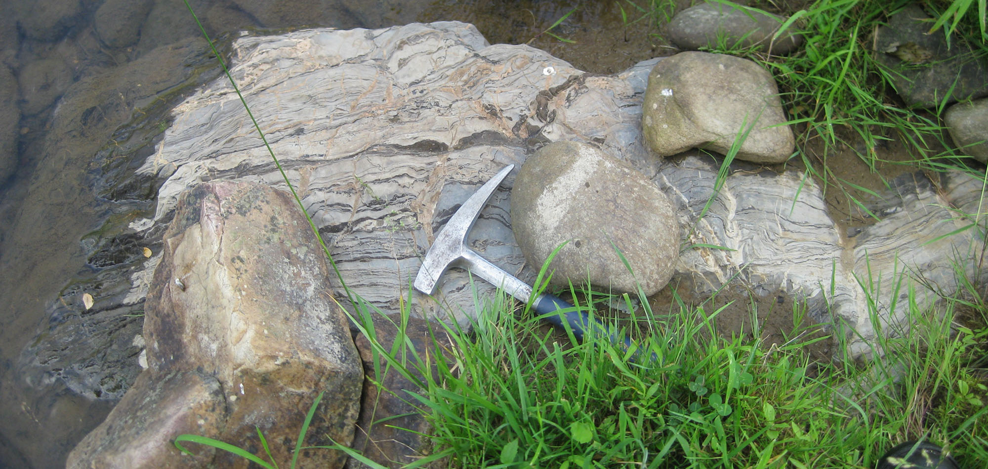
Above, well-developed algal stromatolite layers in the Silurian Tonoloway Limestone in Sitlington Creek southeast of Dunmore, WV.
A total of 31 bedrock samples were collected for geochemical analysis during the field season. These analytical results have been combined with results from past year's STATEMAP projects in a geochemical database available to the general public as West Virginia Geological Survey Report of Investigations RI-34 (McDowell, 2001). Concurrent with this year's STATEMAP project, the geochemical database has been brought up to date and summary statistics fully revised. A GIS-compatible version of the database is currently available.
![]()
![]()
Page last revised June 2010
Page created and maintained by:
            West Virginia Geological & Economic Survey
  Address:  Mont Chateau Research Center
            1 Mont Chateau Road
            Morgantown, WV  26508
Telephone:  1-800-WV-GEOLOgy (1-800-984-3656) or 304-594-2331
      FAX:  304-594-2575
    Hours:  8:00 a.m. - 5:00 p.m. EST, Monday - Friday
Permission to reproduce this material is granted if acknowledgment is given
to the West Virginia Geological and Economic Survey.