 STATEMAP Project for 2011:
Cloverlick Quadrangle
STATEMAP Project for 2011:Preliminary Bedrock Geologic Map of the Cloverlick Quadrangle
Publication OF-1102
Principal Investigators: Ronald McDowell, Paula Hunt, Phil Dinterman, Eric Lewis, Keri Wilson, Katharine Lee Avary (WVGES)
Geological Assistants: Mary Sue Burns (Pocahontas County High School, Dunmore, WV); Christine Smith (Pocahontas County Board of
Education, Dunmore, WV)
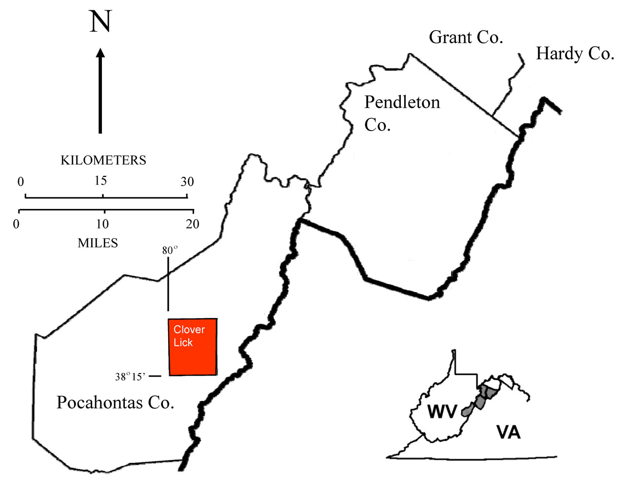
Reconnaissance bedrock mapping and geochemical sampling were carried out on the Cloverlick, West Virginia Quadrangle (see location map above) from May 2009 through May 2012 by investigators Ronald McDowell, Paula Hunt, Eric Lewis, Keri Wilson, and Katharine Lee Avary (WVGES). Two secondary school teachers, Mary Sue Burns (Pocahontas High School, Dunmore, WV) and Christine Smith (Pocahontas County Board of Education, Dunmore, WV), worked as geological field assistants for the 2009-2010 field season. Funding for their salaries and field expenses was provided by the West Virginia Geological and Economic Survey.
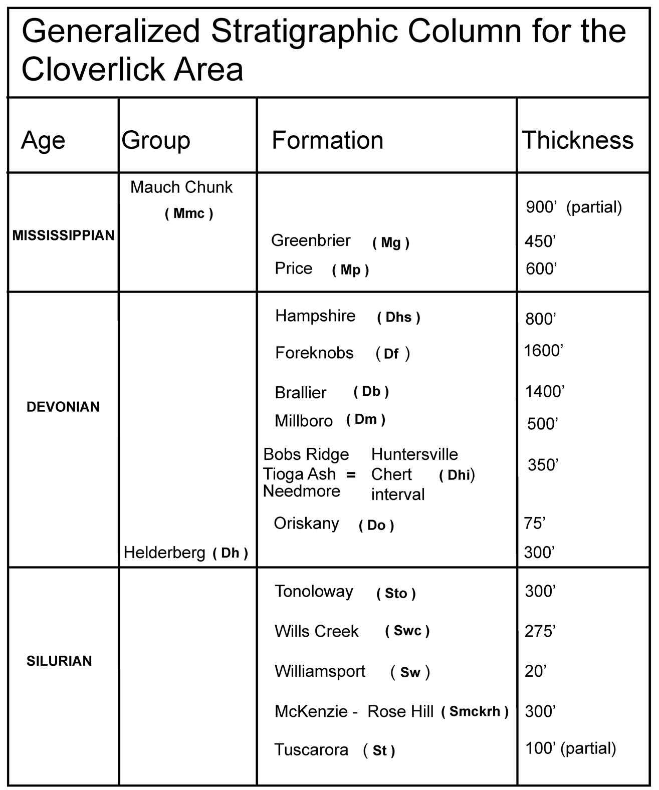
Rock units in the Cloverlick area range in age from Silurian through Mississippian. Shown above is a chart of the stratigraphic units encountered in the mapping area.
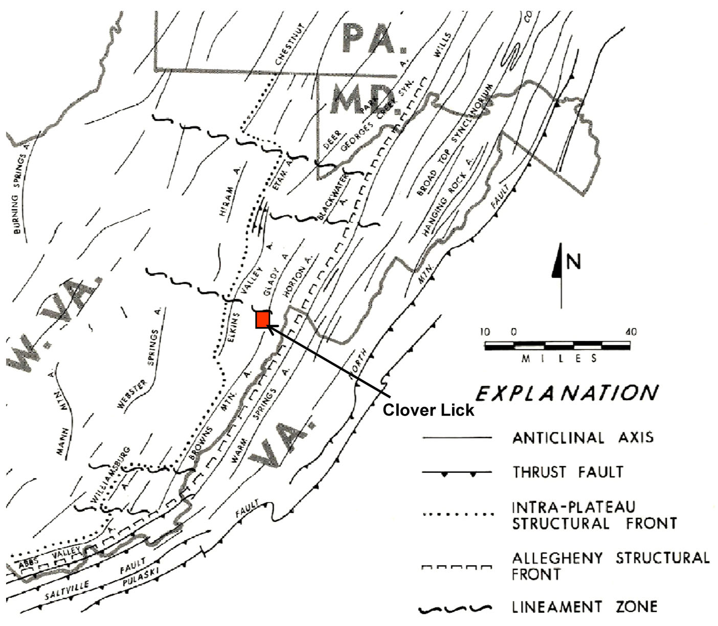
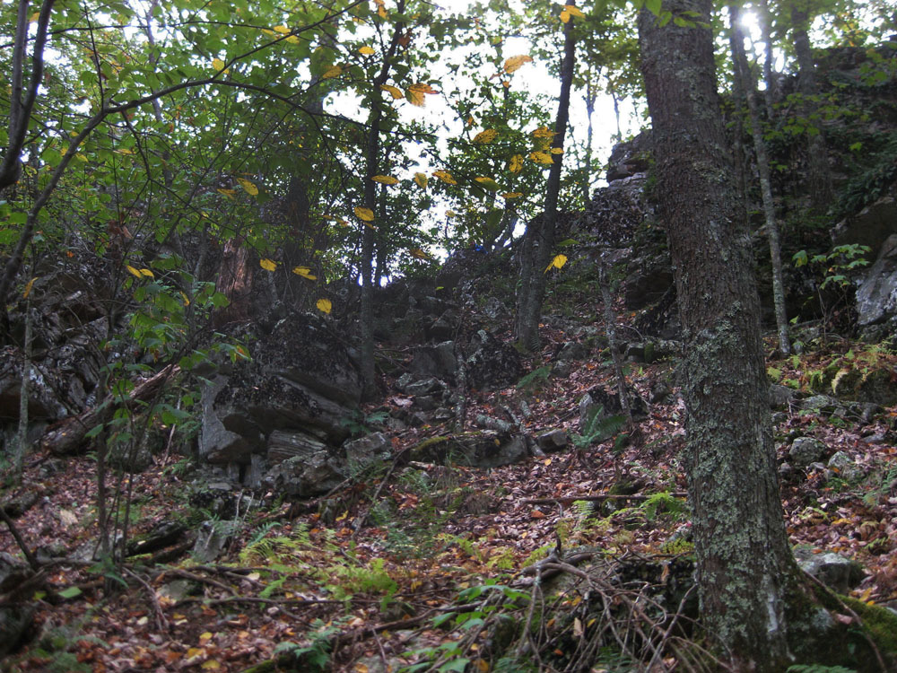
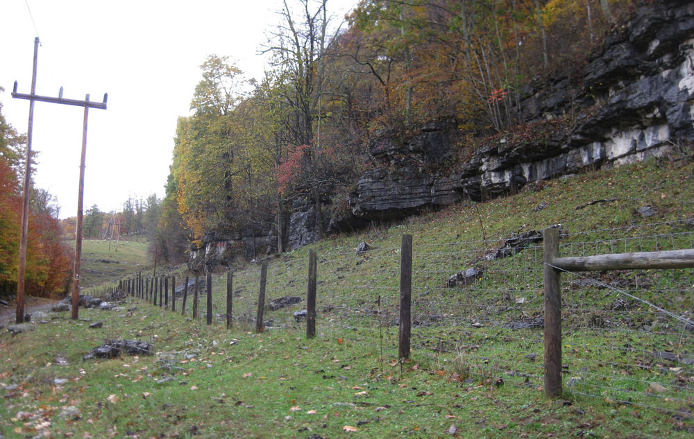
The Cloverlick Quadrangle lies between the Allegheny Front to the east and the Appalachian Plateau to the west. As a result, the Quadrangle exhibits a mixture of very complex and only moderate deformation. Deformation takes the form of folding and faulting and is most notable in the central portion of the Quadrangle. Strikes, fold axes, and fault traces generally trend northeast-southwest. Intense folding in the central and eastern portions of the map area associated with the Brown's Mountain Anticline was probably initiated by thrust faulting deeply "rooted" in Silurian or Ordovician shales present in the subsurface. Deformation propagates readily through overlying units resulting in west-vergent compressional folding of strata in the area. The Silurian Tuscarora Sandstone is the dominant ridge former in the center of the Quadrangle. In the northern portion of the map area, resistant sandstones of the Devonian Hampshire and Mississippian Price formations cap highlands. As observed on quadrangles farther to the north, where exposed, the Silurian Williamsport Sandstone forms an excellent marker bed when interpreting the complex structure in the map area. The photo below shows the Silurian Tuscarora Sandstone on the crest of Michael Mountain. View is to the east looking at the bottom of rock on the east limb of the Brown's Mountain Anticline.
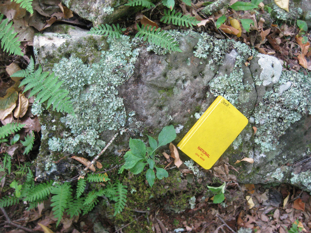
Above, numerous examples of Arenicolites, vertical dwelling trace fossils, on the top of a block of Silurian Williamsport Sandstone west of Frost, WV. Notebook for scale.
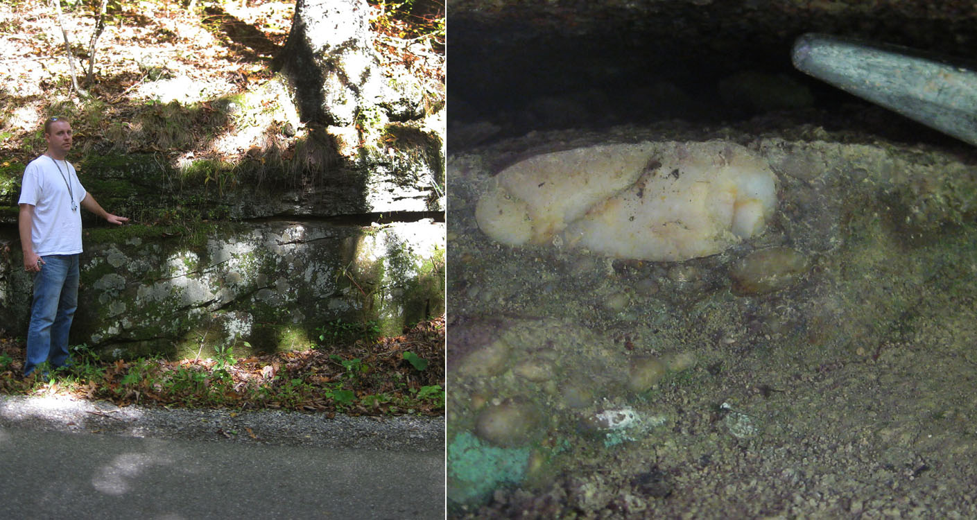
Heavy vegetation and soil cover hamper the delineation of contacts except where the most resistant units are present; in addition, extremely limited road and trail access forced the authors to rely heavily on aerial photography, SLAR imagery, and the Dissertation map of Kulander, 1968, for the interpretation of structure and stratigraphic contacts. In addition, a number of the Mississippian map units were so poorly exposed that their characterization had to be taken from the adjacent Edray Quadrangle to the west. In previous years, the Devonian Needmore and Millboro shales have been observed as distinct mapping units, generally separated by the thin Tioga Ash. For this project, the situation was complicated by the presence of multiple Tioga ashfall layers observed to be interbedded with both the Needmore and a glauconitic sandstone, the Bobs Ridge. Further complicating the situation, much of the Needmore, Tioga, and Bobs Ridge were heavily silicified and as a result, the Needmore and Millboro could not be consistently differentiated. Instead, the Millboro was mapped as a distinct unit and the silicified material was mapped as the Huntersville Chert "interval." Likewise, the Silurian McKenzie and Rose Hill Formations, which are distinctive, mappable units farther to the north because of the presence of the intervening Keefer ironstone and prominent ferruginous sandstones in the Rose Hill, were greatly reduced in thickness. We believe this thinning is related to changing of sedimentary facies which resulted in the loss of resistant sandstones in the Rose Hill - the two units were not differentiated within the map area. The Mississippian Mauch Chunk Group was also problematic in that only the most resistant carbonate (Bluefield Member) and sandstone (Hinton Member) units were visible in outcrop. The dark red mudstones of the Mauch Chunk were consistently, poorly exposed. Below left, outcrop of dolomicrite in the Mississippian Bluefield Formation of the Mauch Chunk Group, northwest of Stony Bottom, WV; below right, two closeups of the same outcrop showing flaser bedding (top) and wavy bedding (bottom). These are marine tidal flat deposits. Hammer for scale.
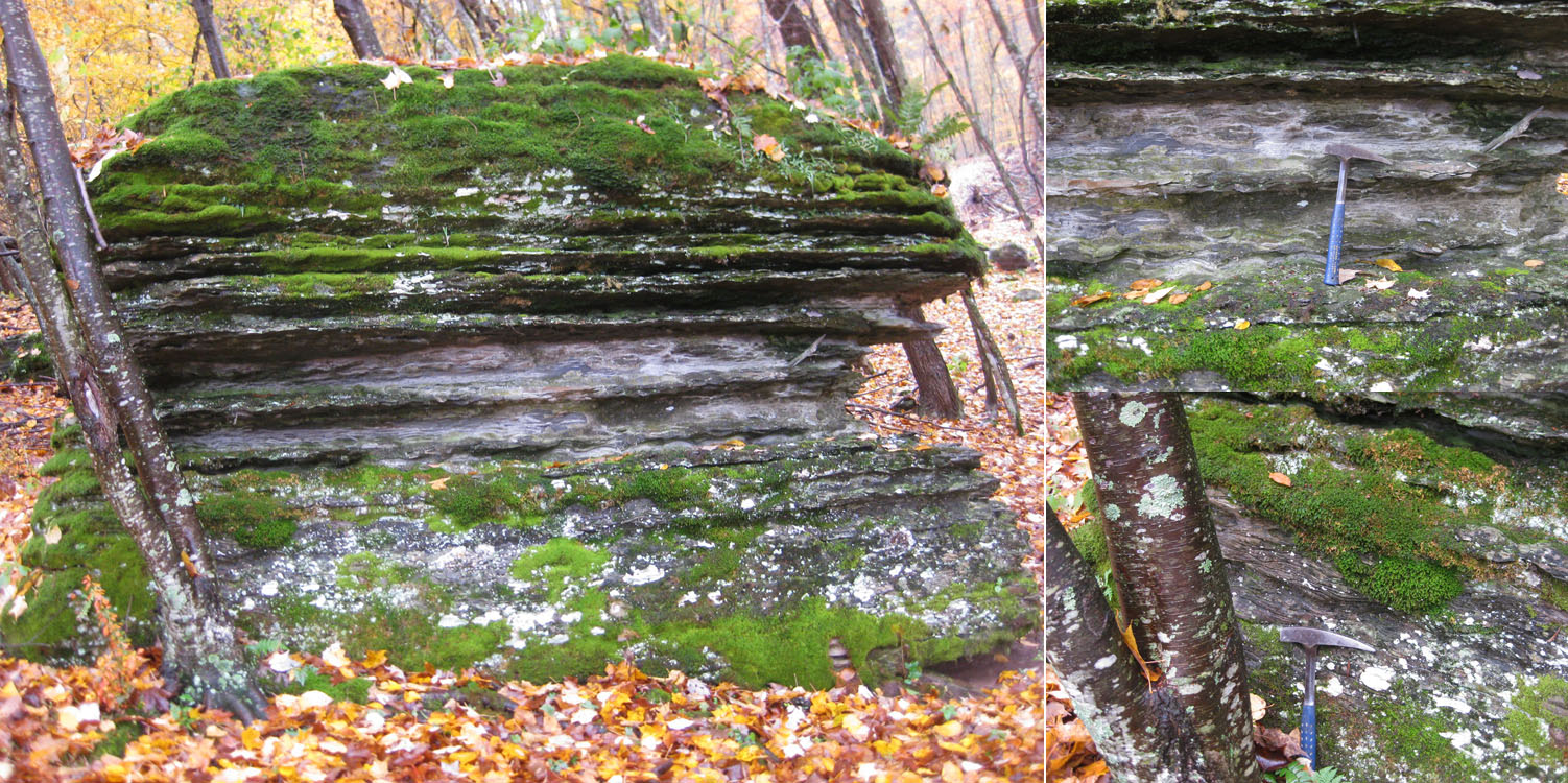
Below, outcrop of flat lying Mississippian Greenbrier Limestone, northwest of Stony Bottom, WV. Outcrop is approximately 5 m thick.
Above left, geologist Eric Lewis points to the contact between the Mississippian Price and Devonian Hampshire - Edray Road, west of Cloverlick, WV; above right, closeup of the quartz pebble lag in the basal Price - point of rock hammer for scale.
Below, numerous examples of an unusual trace fossil (Phycosiphon sp.) found in the basal Price Formation in the study area. Specimen recovered northwest of Cloverlick, WV. Coin is 3 cm in diameter.

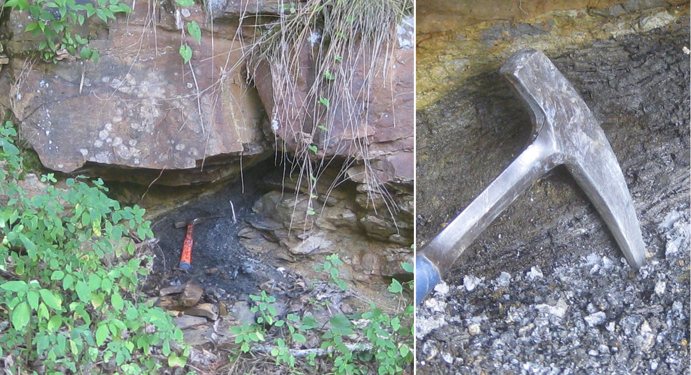
Below, outcrop of Devonian Hampshire sandstone just north of Cloverlick, WV containing a 10 cm thick pod of coal. Hammer for scale.
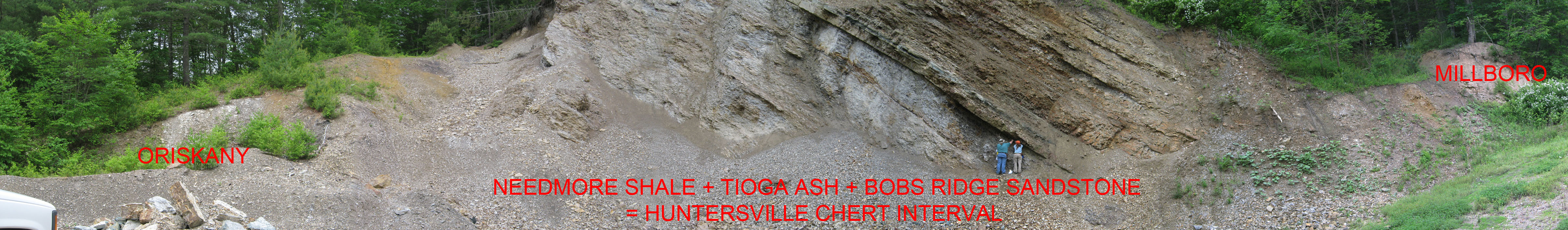
Above, geologists Ron McDowell and Keri Wilson look at the Devonian Bobs Ridge Sandstone at the Cove Hill Quarry, northwest of Frost, WV along Pocahontas County 13. The entire section from the Devonian Oriskany Sandstone (on the left) to Devonian Millboro Shale (on the right) is present here and the problematic Huntersville Chert interval is particularly well exposed.
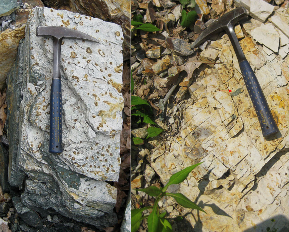
Below left, block of interbedded Tioga Ash and Bobs Ridge Sandstone from the Huntersville Chert interval at the Cove Hill Quarry, northwest of Frost, WV. Circular features are the openings to numerous examples of the vertical trace fossil Arenicolites sp., all filled with silicified ash and surrounded by iron mineralization. Hammer for scale.; Below right, block of silicified Tioga Ash from the Huntersville Chert interval in the Frost Quarry, south of Frost, WV along WV 92. Note the regular jointing that would not be apparent if the Tioga was not silicified. Arrow points to a clast of Bobs Ridge Sandstone. Hammer for scale.
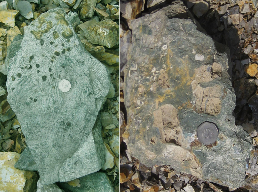
Above left, block of interbedded Devonian Bobs Ridge Sandstone and Devonian Tioga Ash at the Cove Hill Quarry, northwest of Frost, WV. The "zebra-striped" appearance is due to the feeding trace fossil "Spirophyton" sp. mixing sediment from the two units. Coin is 3 cm in diameter; above right, block of Bobs Ridge Sandstone from the Huntersville Chert interval at the Frost Quarry, south of Frost, WV. Partially dissolved chert nodules are visible. Coin is 3 cm in diameter.
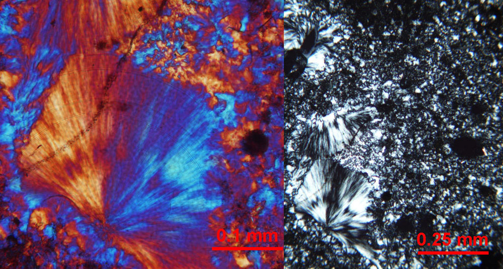
Below, thin section photomicrograph of chalcedony (SiO2) in the Huntersville Chert interval from the Frost Quarry, south of Frost, WV. Crossed polars on the right; on the left, crossed polars with 1/4-wave accessory plate inserted to shift the colour spectrum.
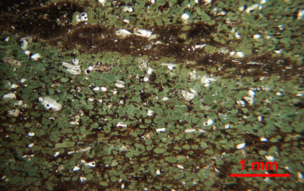
Above, thin section photomicrograph of glauconite ((K,Na)(Fe3+,Al,Mg)2(Si,Al)4O10(OH)2) fecal pellets in the Devonian Bobs Ridge Sandstone from the Cove Hill Quarry, northwest of Frost, WV. Plain light.
A total of 43 bedrock samples were collected for geochemical analysis during the field season. These analytical results have been combined with results from past year's STATEMAP projects in a geochemical database available to the general public as West Virginia Geological Survey Report of Investigations RI-34 (McDowell, 2001). Concurrent with this year's STATEMAP project, the geochemical database has been brought up to date and summary statistics fully revised. A GIS-compatible version of the database is currently available.
![]()
![]()
Page last revised June 2012
Page created and maintained by:
            West Virginia Geological & Economic Survey
  Address:  Mont Chateau Research Center
            1 Mont Chateau Road
            Morgantown, WV  26508
Telephone:  1-800-WV-GEOLOgy (1-800-984-3656) or 304-594-2331
      FAX:  304-594-2575
    Hours:  8:00 a.m. - 5:00 p.m. EST, Monday - Friday
Permission to reproduce this material is granted if acknowledgment is given
to the West Virginia Geological and Economic Survey.