 STATEMAP Project for 2013:
Marlinton Quadrangle
STATEMAP Project for 2013:Preliminary Bedrock Geologic Map of the Marlinton Quadrangle
Publication OF-1302
Principal Investigators: Ronald McDowell, Jaana Hitzig, Paula Hunt (WVGES)
Geological Assistants: Mary Sue Burns (Pocahontas County High School, Dunmore, WV) and Christine Smith (Pocahontas County Board of Education, Marlinton, WV)
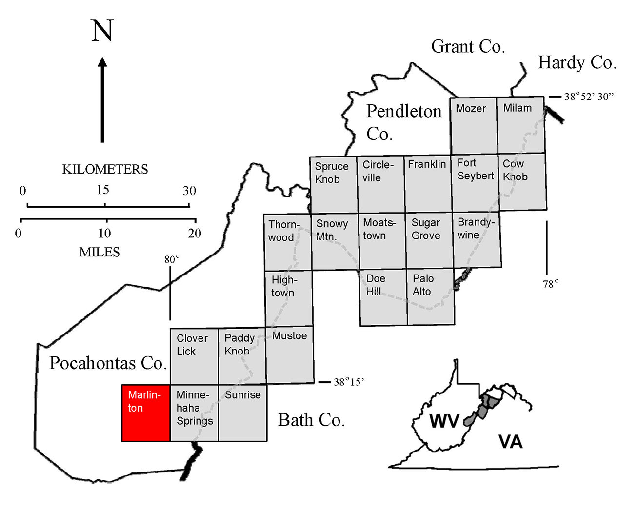
Reconnaissance bedrock mapping and geochemical sampling were carried out on the Marlinton Quadrangle, West Virginia (see location map above) from June 2013 through May 2014 by investigators Ronald McDowell, Jaana Hitzig, Paula Hunt (WVGES). Teachers, Mary Sue Burns (Pocahontas High School, Dunmore, WV) and Christine Smith (Pocahontas County Board of Education, Marlinton, WV), worked as geological field assistants for a portion of the 2013-2014 field season.
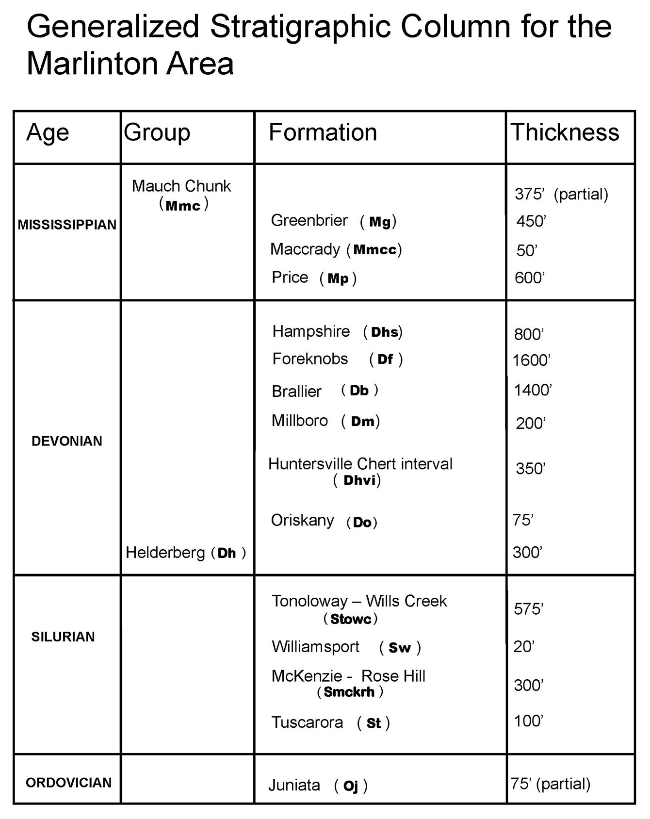
Rock units in the Marlinton area range in age from Ordovician through Mississippian. Shown above is a chart of the stratigraphic units encountered in the mapping area.
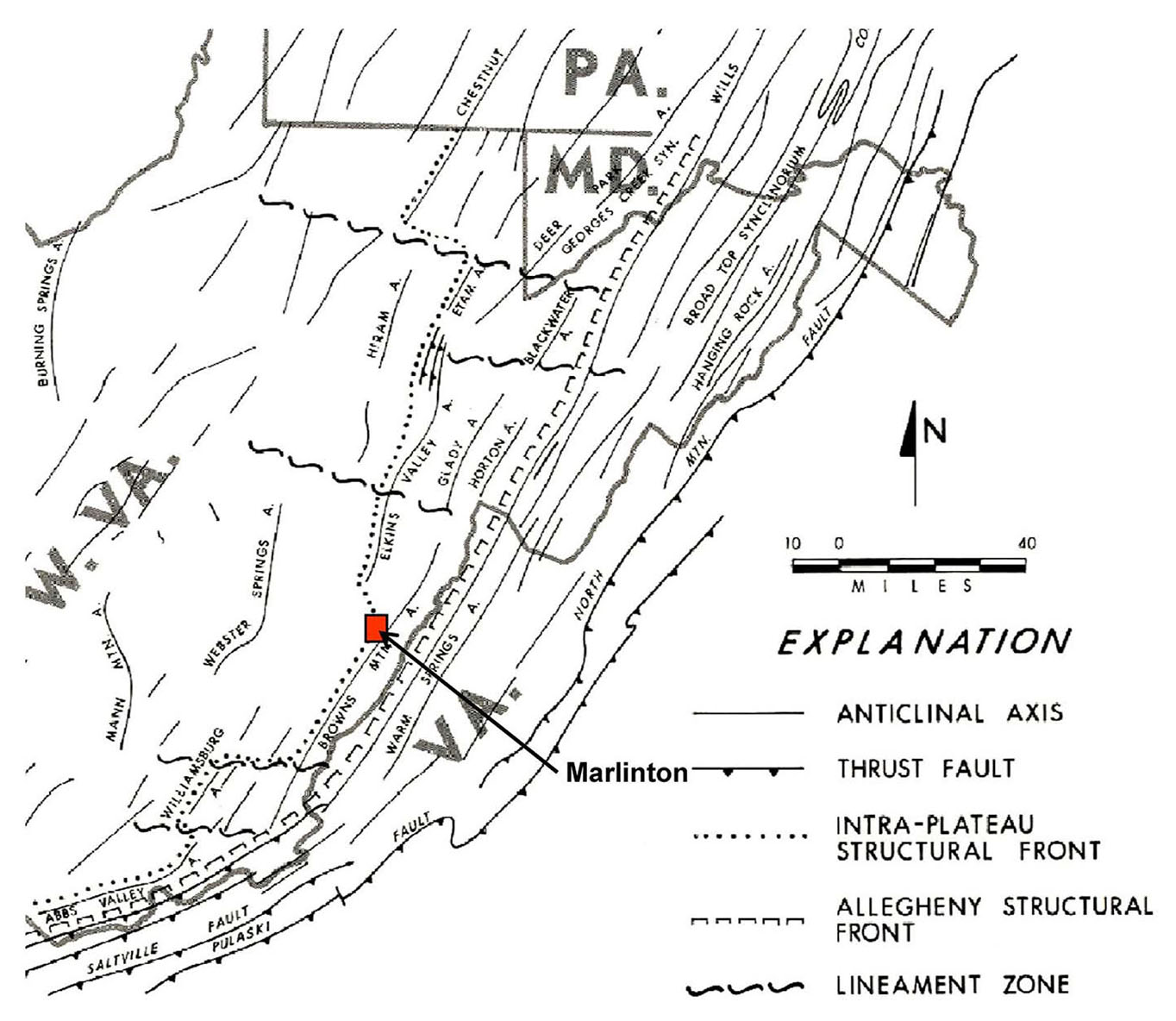
The Marlinton Quadrangle lies between the Allegheny Front to the east and the Appalachian Plateau to the west (see map above from Kulander and Dean, 1978). As a result, bedrock on the Quadrangle exhibits a mixture of very complex and only moderate deformation. Deformation takes the form of folding and faulting and is most notable in the eastern portion of the Quadrangle. Strikes, fold axes, and fault traces generally trend northeast-southwest. Cross-sections prepared with the geologic map suggest that intense folding in the eastern portion of the study area associated with the Brown's Mountain Anticline was probably initiated by thrust faulting deeply "rooted" in Ordovician shale present in the subsurface. Deformation propagated readily through overlying units resulting in west-vergent compressional folding of strata in the area. The Silurian Tuscarora Sandstone is the dominant ridge former in the study area and is prominently exposed in Devils Backbone, an erosionally breached anticlinal feature on the east edge of the Quadrangle. Elsewhere in the Quadrangle, where exposed, the Silurian Williamsport Sandstone can also serve as an excellent marker bed when interpreting the complex structure in the map area.
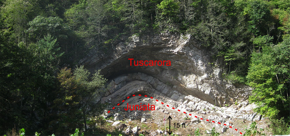
Below, Devil's Backbone - the core of Browns Mountain Anticline breached by Knapp Creek and exposed along WV 39/92, southeast of Huntersville, WV.
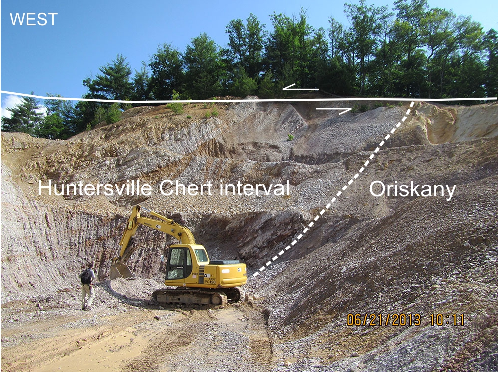
Above, Evidence for a major west-vergent thrust fault exposed in the Farmhouse Lane Quarry, south of Huntersville, WV. Quarry exploits the Devonian Huntersville interval and Oriskany Sandstone in the fault's lower plate. At this location, the upper plate has been eroded away. WVGES Geologist Jaana Hitzig for scale.
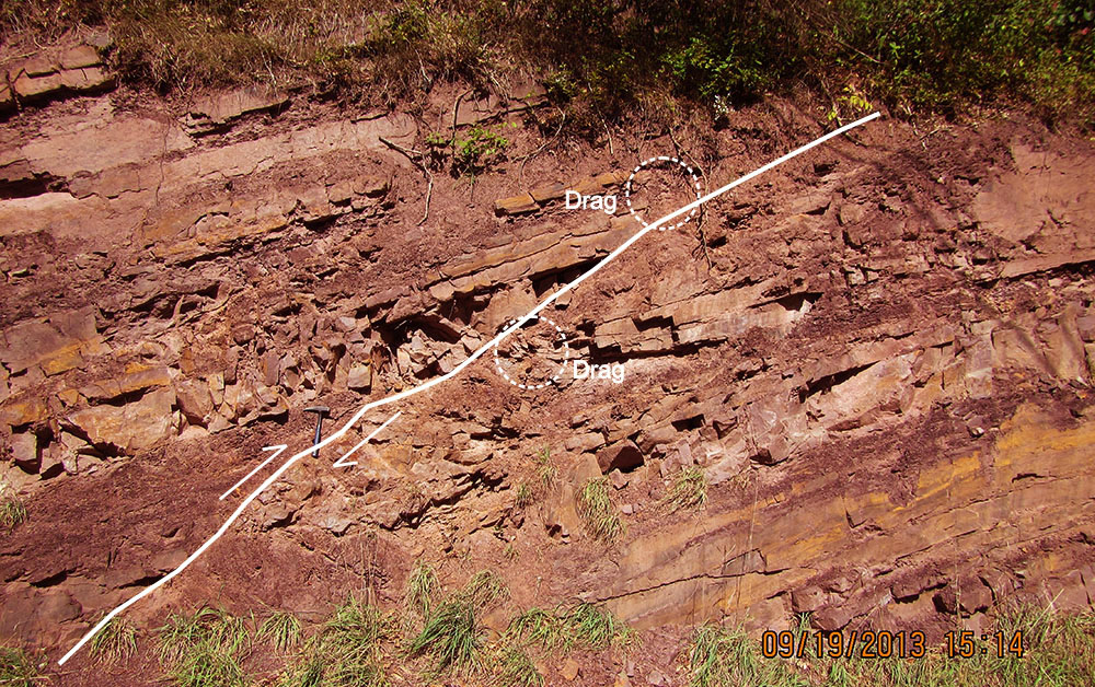
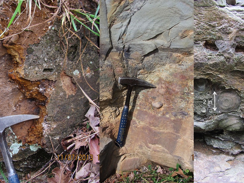
Below, reverse fault with drag exposed in the Ordovician Juniata Formation along WV 39/92, southeast of Huntersville, WV (west to the left). Rock hammer for scale.
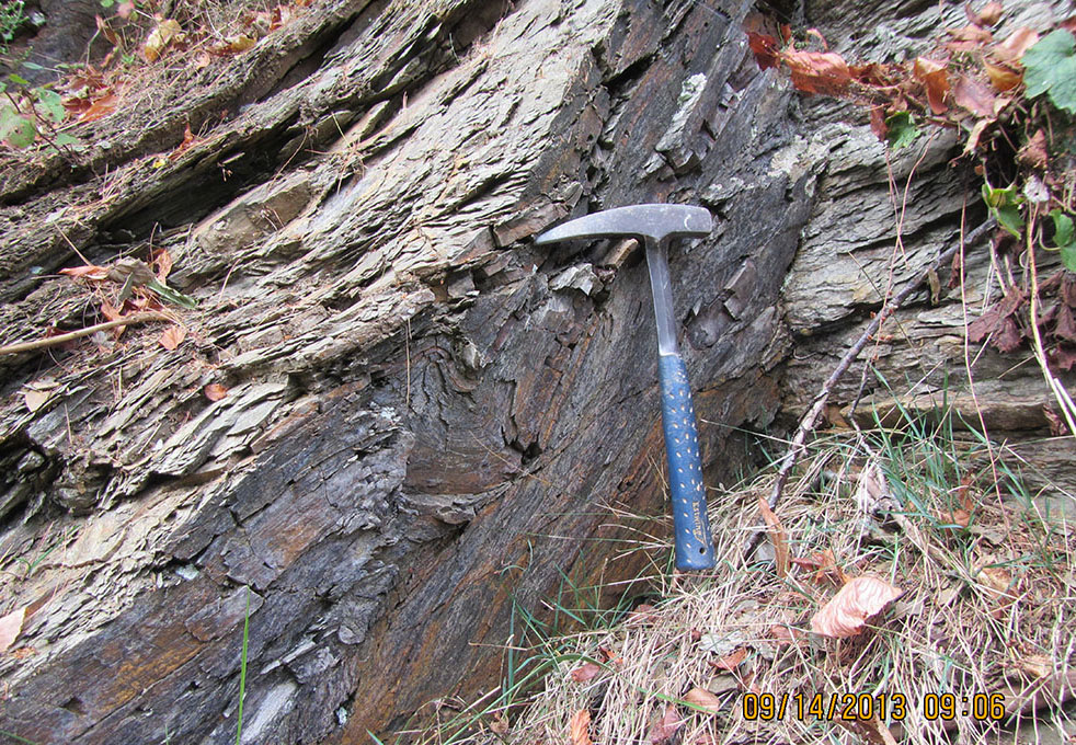
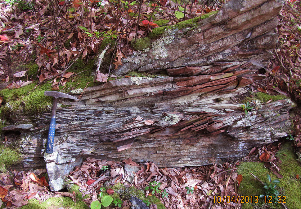
Above, intense folding in the Devonian Mandata Shale Member of the Helderberg Group exposed along WV 39/92, just southeast of Huntersville, WV. Rock hammer for scale.
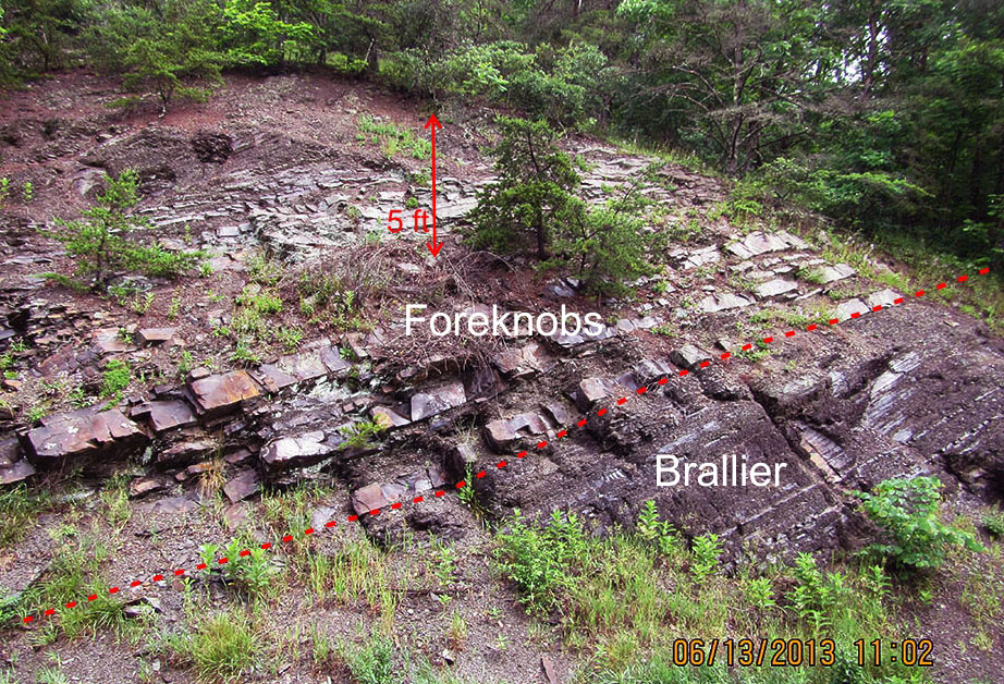
Heavy vegetation and soil cover hamper the delineation of contacts except where the most resistant units are present; in addition, extremely limited road and trail access forced the authors to rely heavily on aerial photography, SLAR imagery, the Pocahontas County Geologic Report of Price and Reger (1929), the Dissertation map of Kulander (1968), and an unpublished field camp project map from West Virginia University (Kammer, 2012, personal communication) for the interpretation of structure and stratigraphic contacts. In addition, a number of the map units were so poorly exposed that their characterization had to be taken from the Cloverlick Quadrangle to the northeast. In past years, the Devonian Needmore and Millboro shales have been observed as distinct mapping units, generally separated by the thin Tioga Ash. Investigation of the Cloverlick Quadrangle in 2011-2012 demonstrated the situation was complicated by the presence of multiple Tioga ashfall layers observed to be interbedded with the Needmore. Further complicating the situation, much of the Needmore and Tioga were heavily silicified. As a result, the Needmore and Millboro could not be consistently differentiated. Instead, the Millboro was mapped as a distinct unit and the silicified material was mapped as the Huntersville "interval." On the Marlinton Quadrangle, the presence of this unit is inferred based on the location of the chert quarry southeast of Huntersville, WV. The Silurian McKenzie and Rose Hill formations, which are distinctive, mappable units farther to the north because of the presence of the intervening Keefer ironstone and prominent ferruginous sandstones in the Rose Hill, were greatly reduced in thickness. We believe this thinning is related to changing of sedimentary facies which resulted in the loss of resistant sandstones in the Rose Hill and the absence of the Keefer - the two units were not differentiated within the map area. In addition, the Silurian Tonoloway and Wills Creek formation were similarly so poorly exposed that they were mapped as an undifferentiated unit. Below, dark red Devonian Minnehaha Springs Member of the Brallier Formation exposed along WV 28, northwest of Huntersville, WV.
Below, typical cross-bedded Devonian Hampshire Formation exposed in the Monongahela National Forest, north of Watoga State Park. Whitish or bleached appearance of the rock may be due to forest fire that apparently burned over this area - notice the piece of charred wood in the bottom center of the photo. Rock hammer for scale.
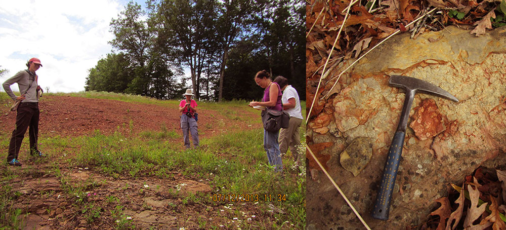
Above, contact between the Mississippian Maccrady and underlying Price formations. On the left, WVGES Geologists Jaana Hitzig, Paula Hunt, Christine Smith, and Mary Sue Burns (left to right) standing on the top of the Price along US 219, north of Marlinton, WV. On the right, closeup of flat-pebble or intraclast conglomerate encountered near the top of the Price along Pocahontas 15, northeast of Marlinton, WV. The presence of this unit suggests that the contact with the overlying Maccrady may be unconformable with original erosional relief present on the uppermost Price surface. Rock hammer for scale.
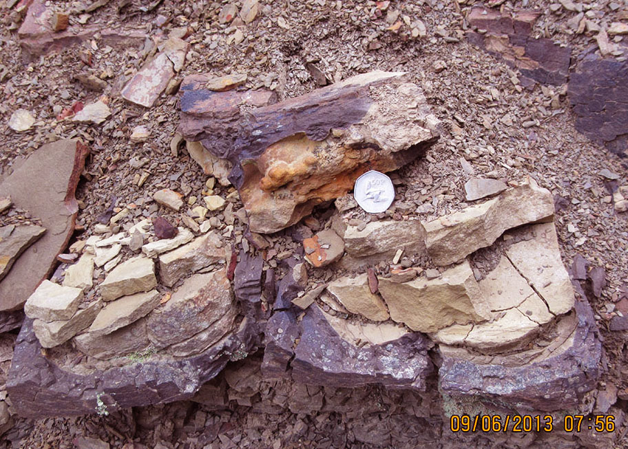
The Price Formation in the Marlinton area is marked by a number of localized conglomerate or lag layers that may represent storm deposits. The coarse materials making up these layers may be some combination of marine body fossils; white quartz pebbles and other rock fragments; or large, limonitic concretions. Shown below are examples of each: left photo of a lag consisting of brachiopod and gastropod fossil voids and quartz granules with rock hammer for scale; middle photo of a lag dominated by quartz pebbles and granules with rock hammer for scale; right photo of a lag consisting of concentric, limonitic concretions and crinoid fossil debris. All photos are from the Marlinton, WV area.
Above, secondary iron mineralization associated with fractures in the Mississippian Price Formation produces boxworks in outcrops along Stillwell Road, south of Marlinton, WV.
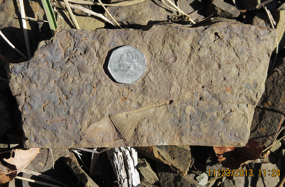
Of all the stratigraphic units exposed in the Marlinton area, the Devonian Foreknobs Formation is probably most known for its content of marine body fossils, trace fossils, and plant debris. Below, a nice example of the brachiopod Cyrtospirifer chemungensis, together with voids of dissolved crinoid and bryozoan debris found along WV 39, southeast of Marlinton, WV. Coin is 3 cm in diameter.
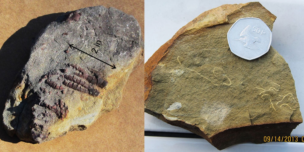
Because the Mississippian Price Formation is so well-exposed in the western part of the Marlinton Quadrangle, its fossil component, althought not usually as prominent as in the Foreknobs, was well represented. Above - left, partially articulated crinoid tentacles found by Christine Smith in the Price, Marlinton, WV. Note: the normally calcitic (CaCO3) composition of the crinoid skeleton has been replaced by siderite (FeCO3); above - right, an example of the feeding trace fossil Phycosiphon sp. recovered from the lowermost Price Formation, east of Marlinton, WV. Coin is 3 cm in diameter.
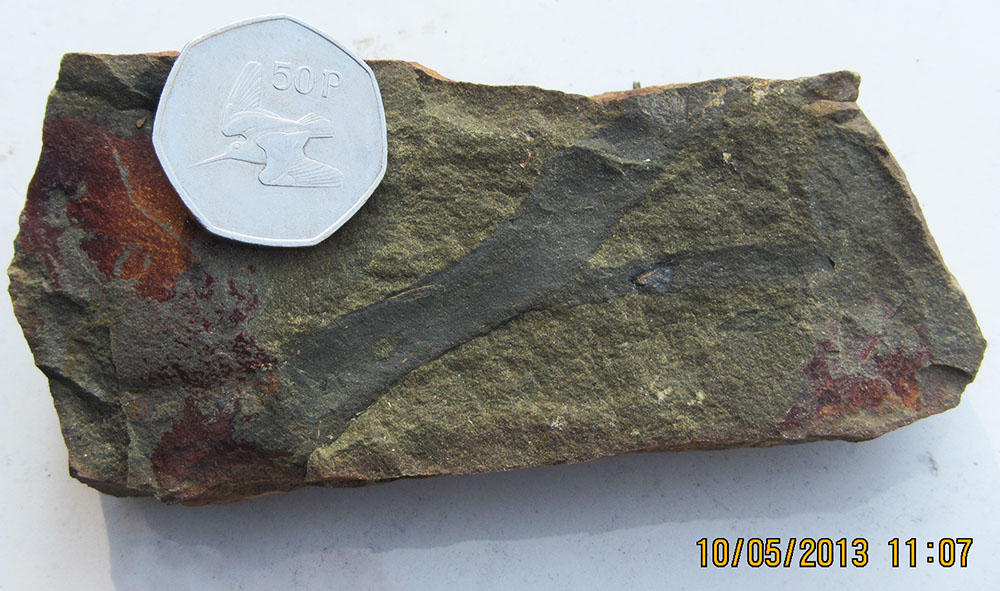
Below, a large fragment of woody plant material recovered from outcrops along Stillwell Road, south of Marlinton, WV. Coin is 3 cm in diameter.
A total of 43 bedrock samples were collected for geochemical analysis during the field season. Their locations are shown on the control map. Results have been combined with data from past year's STATEMAP projects in a geochemical database available to the general public as West Virginia Geological Survey Report of Investigations RI-34 (McDowell, 2001). Concurrent with this year's STATEMAP project, the geochemical database has been brought up to date with the inclusion of new results. A GIS-based version of this database is available.
![]()
![]()
Page last revised May 2014
Page created and maintained by:
            West Virginia Geological & Economic Survey
  Address:  Mont Chateau Research Center
            1 Mont Chateau Road
            Morgantown, WV  26508
Telephone:  1-800-WV-GEOLOgy (1-800-984-3656) or 304-594-2331
      FAX:  304-594-2575
    Hours:  8:00 a.m. - 5:00 p.m. EST, Monday - Friday
Permission to reproduce this material is granted if acknowledgment is given
to the West Virginia Geological and Economic Survey.