
🍂 April 22nd is international Earth Day! 🍂
WVGES will
celebrate Earth Day all April by offering a 22% discount on select publications
—a different
series for each week!
Download this page as a PDF (![]() PDF, 926 KB)
PDF, 926 KB)
🍂 Week 1 (April 4-8)
 Go out and explore
our Wild and Wonderful Mountain state. You’ll need a topo map! Take 22% off
-- All of our topo maps from 1:24:000 to 1:100,000.
Go out and explore
our Wild and Wonderful Mountain state. You’ll need a topo map! Take 22% off
-- All of our topo maps from 1:24:000 to 1:100,000.
Go to our Interactive Topographic Map (http://ims.wvgs.wvnet.edu/topo/) to find the quad(s) of interest.
· 1:24,000 7.5’ standard (Map-X1), no green woodland (Map-X2), no green woodland or contour lines (Map-X3). Map-X1, Map-X2, Map-X3 normally: $8.00 -- During the week of April 4 to 8th: $6.24 (22% discount).
· 1:62,500, 15’ most are out-of-print; please inquire! Folded or rolled (Map-X4). Map-X4 normally: $5.00 -- During the week of April 4 to 8th: $3.90 (22% discount).
· 1:100,000 scale 30’x60’, metric, folded (Map-X13). Map X-13 normally: $9.00 -- During the week of April 4 to 8th: $7.02 (22% discount).
🍂 Week 2 (April 11-15)
It’s about time to start thinking of a summer vacation (or a “WV Staycation”)! Explore some of our great state parks. You may even find a fossil! These books may help!
 Discover
more about West Virginia’s ancient plant life with our popular paperback,
Discover
more about West Virginia’s ancient plant life with our popular paperback,
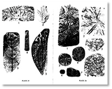
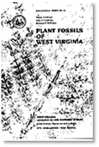
Plant Fossils of West Virginia" (ED-3A)
W.H. Gillespie, J.A. Clendening, and H.W. Pfefferkorn, 1978, 172 pages, 64 plates, 20 figures. This classic gem is organized chronologically from Precambrian to Recent, and includes chapters on how and where fossils occur, collecting and preservation methods, and spores and pollens. Thoroughly indexed.
Normally: $8.00.
During the week of April 11 to 15th: $6.24 (22% discount).
Also during the week of April 11-15, take 22% off of our State Park Bulletins (pamphlets).
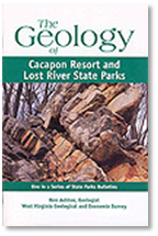 The Geology of
Cacapon Resort and Lost River State Parks
The Geology of
Cacapon Resort and Lost River State Parks
State Park Bulletin, SP-7 is a highly-illustrated geological tour through these two eastern panhandle state parks in the Valley and Ridge physiographic province. Cacapon Resort State Park is in Morgan County, and Lost River State Park is in Hardy County. The 36-page booklet describes the rocks and geologic history that visitors will encounter in each park, and explains each park's topography and prominent geological features. In addition to text written for the non-specialist, the booklet is filled with explanatory illustrations and beautiful photographs. Fold-out colored geologic maps identify the rock units visible in each park area.
Normally: pamphlet for $5.95. During the week of April 11 to 15th: $4.64 (22% discount).
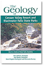
The Geology of Canaan Valley Resort and Blackwater Falls State Parks
State Park Bulletin SP-6A follows a similar format for these two eastern West Virginia state parks in Tucker County, in the Allegheny Mountain Section of the Appalachian Plateau physiographic province. The highly-illustrated 32-page booklet describes the geology, rocks, and landforms in these parks, including the geology responsible for the formation of the falls of the Blackwater River and the broad valley at Canaan. Fold-out colored geologic maps identify the rock units visible in each of these parks areas.
Normally: pamphlet for $5.95. During the week of April 11 to 15th: $4.64 (22% discount).
Our older State Park Bulletin pamphlets are also available at discount. Normally: pamphlet for $5.00. During the week of April 4 to 8th: $3.90 (22% discount).
These black and white booklets measure 5.5'' by 8.5''. We are gradually updating these classic bulletins, so when these are gone, they're gone for good! They have a patina, but that just makes them more special.
 SP-1,
The Geology of Hawks Nest State Park, West Virginia: J. C. Ludlum, 1951,
25 p, 9 pl, 4 f., Geology and geography of the famous New River Gorge at Hawks
Nest, Fayette County.
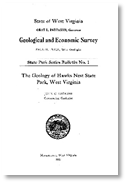
SP-1,
The Geology of Hawks Nest State Park, West Virginia: J. C. Ludlum, 1951,
25 p, 9 pl, 4 f., Geology and geography of the famous New River Gorge at Hawks
Nest, Fayette County.
SP-2, The Geology of Cacapon State Park, West Virginia: J. C. Ludlum, 1952, 33 p, 18 pl, 4 f. Geology, geography, and natural resources of Cacapon State Park, Morgan County. Note: this publication is replaced by SP-7, above.
SP-3, The Geology of Lost River State Park, West Virginia: J. C. Ludlum, 1952, 33 p, 21 pl, 3 f. Geology and natural resources of Lost River State Park, Hardy County. Replaced by SP-7
SP-4, The Geology of Watoga and Droop Mountain Battlefield State Parks, West Virginia: J. C. Ludlum, 1954, 40 p, 17 pl, 3 f. Popular account of geology, history, and resources of two State parks in Pocahontas County.
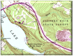
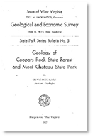
SP-5, Geology of the Coopers Rock State Forest and Mont Chateau State Park: C. E. Hare, 1957, 26 p, 14 pl, 3 f. Geology and resources of Coopers Rock State Forest in Monongalia and Preston Counties, and Mont Chateau State Park in Monongalia County.
🍂 Week 3 (April 18-22)
During the week of April 18-22, all of our Bulletins (“B” series publications) and Volumes (“V” series publications) are discounted 22% off of the list price. There are 55 and 41 titles available for each, respectively.
 These
publications are the cornerstone of the Survey’s research throughout the years!
Many are also real classics!
These
publications are the cornerstone of the Survey’s research throughout the years!
Many are also real classics!
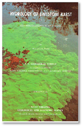
Bulletins include such works as Fifty Common Rocks and Minerals of West Virginia by J.H.C. Martens, 1945, 42 pages (B-9) and Hydrology of Limestone Karst by W.K. Jones, 1943, 49 pages (B-36). Folks who are fans of Mississippian limestones and who have interest in Greenbrier County should like this example!
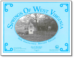
A fine example of one of our Volumes is the updated Springs of West Virginia by J.S. McColloch, 1986, 493 pages (V-6A). This publication is the 50th anniversary revision of V-6 and is published with the American Fisheries Society and The Conservation Fund, Inc. Compilation of all available data on the 1,193 documented springs in 49 of West Virginia's 55 counties. Includes 1:250,000-scale county location maps; spring listings by county; brief history; discussion of geologic/geographic occurrence of springs; tables of chemical/physical data; glossary; index.
Please visit our online publications catalog http://www.wvgs.wvnet.edu/wvges2/publications/PubCat_DetailSearch.aspx) and select either Publication Type “Bulletins” or “Volumes” to see what is available. Many publications in these categories are only available on a CD or DVD and prices vary. You can also download a spreadsheet list of Bulletins here and Volumes here.
🍂 Week 4 (April 25-29)
 If you are really
into geology and enjoy mapping with GIS, the week of April 25-29 features all
Open-File GIS map products (contains georeferenced TIFF imagery and/or shapefile
sets)-- discounted by 22%. These publications especially pertain to bedrock
and surficial geology!
If you are really
into geology and enjoy mapping with GIS, the week of April 25-29 features all
Open-File GIS map products (contains georeferenced TIFF imagery and/or shapefile
sets)-- discounted by 22%. These publications especially pertain to bedrock
and surficial geology!
Please see the “Geologic Mapping, including STATEMAP Projects” page (http://www.wvgs.wvnet.edu/www/statemap/statemap.htm ) for status of 1:24,000 scale maps.
Search the Publication Type “Open-File Reports” on (http://www.wvgs.wvnet.edu/wvges2/publications/PubCat_DetailSearch.aspx for these and other maps as well.
Bonus Item!
 For the whole
month of April, get the monumental, hard-backed Volume,
For the whole
month of April, get the monumental, hard-backed Volume,
West Virginia Gazetteer of Physical and Cultural Place Names for just $9.99. The list price is normally $35.00.
Also, if you have an order of $50 or more of the above items,
we’ll include it for FREE!
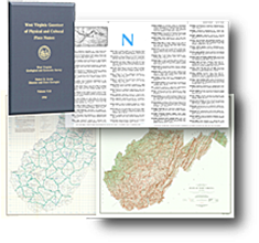
V-24, West Virginia Gazetteer of Physical and Cultural Place Names
1986, 809 pages, 6 figures, 3 maps. Alphabetically lists place names in West Virginia, and for each name shows what the place name is (town, church, stream, etc.), county, tax district, USGS 7.5-minute quadrangle map, Universal Transverse Mercator coordinates, and elevation in feet and meters. Place names are from USGS 7.5-minute maps, 15-minute maps, the Survey's County Geologic Report maps, and other sources. Maps show locations of major place names, counties, tax districts, quadrangles, and relief. Includes MAP-WV21 (index to quadrangles), MAP-WV22 (UTM), and MAP-WV23 (shaded relief), all 1:500,000 scale. Types of place names listed: airports, archeological sites, bends, bottoms, bridges, caves, cemeteries, communities, country clubs, dams, fords, gaps, hollows, institutions, islands, knobs, lakes, monuments, mountains, natural features, overlooks, parks, places of worship, power plants, railroads, recreation areas, ridges, roads, schools, springs, streams, towers, trails, triangulation stations, tunnels, valleys, waterfalls, and wetlands.
Ordering:
① View list prices from the Online Publications
Catalog (http://www.wvgs.wvnet.edu/wvges2/publications/PubCat_DetailSearch.aspx
) or download a PDF of the Publications Price List (http://downloads.wvgs.wvnet.edu/pubcat/docs/PriceListFinal_2016.pdf) ![]() .
.
② Download our order form from here: http://downloads.wvgs.wvnet.edu/pubcat/docs/OrderForm_20160127.pdf ![]()
Note: Apply the 22% discount before entering items in the “Price/Each” column.
If not ordering by mail, please stop by the Survey in Morgantown during the week from 8:30 am to 4:30 pm.
See Google Map
Phone: 304-594-2331
![]()