
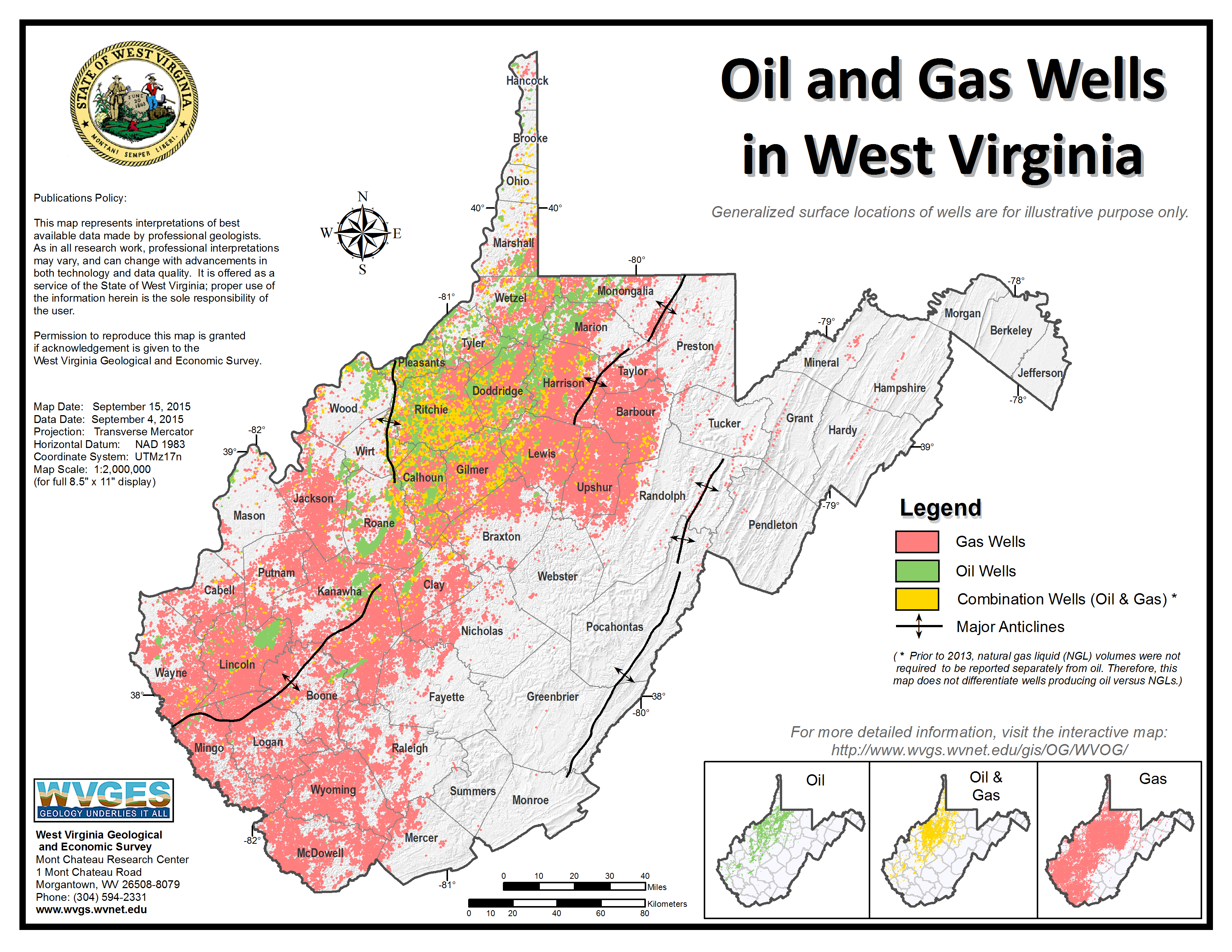
 Generalized Geologic Map of the Coal Fields (MAP_WV2_GeneralizedGeologicMapCoalFieldsWVpagesize.pdf--631 KB) Probable Original Minable Extent (mpcomnbl_Map27.pdf--596 KB) Coal Rank Map (mpcorank_MapWV8.pdf--604 KB) Generalized Ash Content (mpcoash_MapWV4.pdf--595 KB) Generalized BTU Heating Value (mpcobtu_MapWV3.pdf--600 KB) Generalized Sulfur Content (mpcoslfr_MapWV1.pdf--597 KB) Oil and Gas Wells in West Virginia (Oil_and_Gas_Wells_in_WV.pdf--2.44 MB). This map is also available as a PNG image.
Gas and Oil Fields (gasandoilfields_MapWV9A.pdf--1362 KB) (Soon to be discontinued. "Oil and Gas Wells in West Virginia" supersedes this map. A new "technical fields" map is in process of development.) Limestone Outcrops and Probable Area Underlain by Rock Salt and Natural Brine (LSOutcropsSaltBrine_Map26.pdf--775 KB) (2.7 MB PDF - lower resolution)
Eastern West Virginia (MAP_WV5_LandsatImage_Eastern_WV_1979.pdf--855 KB); Western West Virginia (MAP WV6 LandsatImage Western WV 1979, pdf--1008 KB)
West Virginia State Plane Coordinate Zones/Counties (wvstpln.pdf--105 KB)
West Virginia GIS Technical Center's Description of State Plane Coordinate System for West Virginia Counties and Map
Showing West Virginia State Plane Coordinate Zones and UTM Zones (spcs_wvcode.pdf)
Topographic Map Symbols (provided by the USGS) (topomapsymbols_MapX1B.pdf--1957 KB)
Generalized Geologic Map of the Coal Fields (MAP_WV2_GeneralizedGeologicMapCoalFieldsWVpagesize.pdf--631 KB) Probable Original Minable Extent (mpcomnbl_Map27.pdf--596 KB) Coal Rank Map (mpcorank_MapWV8.pdf--604 KB) Generalized Ash Content (mpcoash_MapWV4.pdf--595 KB) Generalized BTU Heating Value (mpcobtu_MapWV3.pdf--600 KB) Generalized Sulfur Content (mpcoslfr_MapWV1.pdf--597 KB) Oil and Gas Wells in West Virginia (Oil_and_Gas_Wells_in_WV.pdf--2.44 MB). This map is also available as a PNG image.
Gas and Oil Fields (gasandoilfields_MapWV9A.pdf--1362 KB) (Soon to be discontinued. "Oil and Gas Wells in West Virginia" supersedes this map. A new "technical fields" map is in process of development.) Limestone Outcrops and Probable Area Underlain by Rock Salt and Natural Brine (LSOutcropsSaltBrine_Map26.pdf--775 KB) (2.7 MB PDF - lower resolution)
Eastern West Virginia (MAP_WV5_LandsatImage_Eastern_WV_1979.pdf--855 KB); Western West Virginia (MAP WV6 LandsatImage Western WV 1979, pdf--1008 KB)
West Virginia State Plane Coordinate Zones/Counties (wvstpln.pdf--105 KB)
West Virginia GIS Technical Center's Description of State Plane Coordinate System for West Virginia Counties and Map
Showing West Virginia State Plane Coordinate Zones and UTM Zones (spcs_wvcode.pdf)
Topographic Map Symbols (provided by the USGS) (topomapsymbols_MapX1B.pdf--1957 KB)

